Austrian States outlines quiz
Only the shape is shown, with no map around it. Can you tell which state it is? A great way to really learn Austrian States.
Top scores
- The five fastest 100% rounds on this quiz.
Finish with 100% and post your time to get on the board – here or in full screen. All leaderboards
Your next quiz
 Swiss Cantons quiz26 cantons
 Swedish Counties quiz21 counties
What's on this map
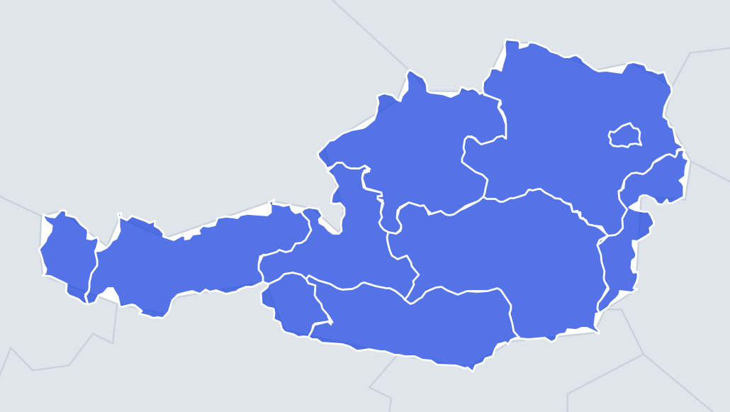
Nine Austrian states shown as outlines. Austria itself is shaped like a long tadpole or a frying pan, wide in the east and narrow in the west, and the states are cut from that shape. Most borders follow mountain ridges and rivers in the Alps, so the outlines are wiggly, with very few straight lines.
The east is the easiest part. Vienna is a small, roundish shape with the Danube running through it. Lower Austria is a large ring with a hole in it where Vienna sits. Burgenland is a long, thin strip running north to south along the Hungarian border, with a narrow waist in the middle near Sopron, which stayed in Hungary.
The places people miss
- Tyrol – two separate pieces. North Tyrol is a long east-west strip along the German border, and East Tyrol is a smaller block further south-east, cut off by Salzburg and Italy. South Tyrol went to Italy in 1919, which is why the state is broken.
- Vorarlberg – a small, upright shape at the far western tip, squeezed between Germany, Switzerland and Liechtenstein, with a short shore on Lake Constance.
- Salzburg – shaped like a boot or a keyhole, with a narrow northern end around the city and a wide body in the mountains to the south.
- Upper Austria – roughly a triangle or rounded square along the German and Czech borders, with the Danube crossing it.
- Carinthia – a long east-west oval along the borders with Italy and Slovenia, full of lakes.
- Styria – a large shape, like a broad leaf or a heart pointing south-east, the second-largest state.
- Lower Austria – the largest state; look for the hole where Vienna is.
How to learn it
- Bank the obvious three first: Vienna (smallest), Lower Austria (has a hole), Burgenland (thin strip in the east).
- Then learn Tyrol's two pieces, which is the shape people get wrong most.
- Compare Carinthia and Styria: Carinthia is long and low; Styria is taller and sits north-east of it.
- Play Outlines until it is 9 of 9, then try Sudden death.
Guides that help with this
- Oceans, seas, rivers and mountainsThe physical map: seas around each continent, the big rivers and ranges.
- Why you forget countries – and how spaced repetition fixes itThe forgetting curve, and how the Mistake Bank and flashcards use it.
- Flags that look alike (and how to tell them apart)Chad or Romania? Australia or New Zealand? The flag pairs that cost quiz points.
How it works
Each question shows one outline and four names. Similar-sized states are mixed in, so it gets tricky.
All 9 states in this quiz
Burgenland, Carinthia, Lower Austria, Salzburg, Styria, Tyrol, Upper Austria, Vienna, Vorarlberg.