Central America outlines quiz
Only the shape is shown, with no map around it. Can you tell which country it is? A great way to really learn Central America.
Top scores
- The five fastest 100% rounds on this quiz.
Finish with 100% and post your time to get on the board – here or in full screen. All leaderboards
Your next quiz
 Europe quiz46 countries
 Africa quiz54 countries
What's on this map
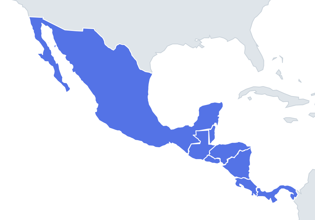
Eight shapes, and the land bridge makes most of them long and thin. Mexico is the easy one: a wide funnel with the long finger of Baja California hanging down the Pacific side and the square thumb of the Yucatán Peninsula pointing north into the Gulf of Mexico. Panama is the other giveaway: a thin, wavy S lying on its side, with the bump of the Azuero Peninsula on its south coast.
Between them, the outlines get harder. Guatemala looks like a box sitting on top of a wedge: the northern Petén region is bounded by straight surveyed lines with Mexico, while the south is irregular volcanic highland. Belize is a narrow upright rectangle with a ragged Caribbean coast. Honduras and Nicaragua are both roughly triangles, which is where most mistakes happen.
The places people miss
- Honduras vs Nicaragua – Honduras has its long, straight side along the top (the Caribbean coast) and narrows to a small Pacific outlet at the Gulf of Fonseca. Nicaragua has its long side running down the right (the Caribbean) and a wide Pacific coast on the left.
- El Salvador – a small, flat oblong with a smooth bottom edge: it is the only one of the eight with no Caribbean coast at all.
- Costa Rica – a slab running diagonally from north-west to south-east, with two hooks on the Pacific side: the Nicoya Peninsula at the top and the Osa Peninsula near Panama.
- Belize vs El Salvador – similar in area, but Belize stands upright and El Salvador lies on its side.
- Guatemala – look for the square northern block; no other shape here has such straight edges.
How to learn it
- Do Find on the map first so you know which coast each shape faces; outlines are much easier when you can picture the sea on one side.
- Learn the two triangles as opposites: Honduras is much wider than it is tall, while Nicaragua is about as tall as it is wide, with a fairly straight east coast.
- Give each shape a picture: Mexico a horn, Guatemala a box, Belize a domino, El Salvador a brick, Costa Rica a slab, Panama a snake.
- Run the outline quiz until you can answer before the shape finishes appearing, then try sudden death.
Guides that help with this
- Oceans, seas, rivers and mountainsThe physical map: seas around each continent, the big rivers and ranges.
- Why you forget countries – and how spaced repetition fixes itThe forgetting curve, and how the Mistake Bank and flashcards use it.
- Flags that look alike (and how to tell them apart)Chad or Romania? Australia or New Zealand? The flag pairs that cost quiz points.
How it works
Each question shows one outline and four names. Similar-sized countries are mixed in, so it gets tricky.
All 8 countries in this quiz
Belize, Costa Rica, El Salvador, Guatemala, Honduras, Mexico, Nicaragua, Panama.