Dutch Provinces outlines quiz
Only the shape is shown, with no map around it. Can you tell which province it is? A great way to really learn Dutch Provinces.
Top scores
- The five fastest 100% rounds on this quiz.
Finish with 100% and post your time to get on the board – here or in full screen. All leaderboards
Your next quiz
 French Regions quiz13 regions
 Spanish Regions quiz16 regions
What's on this map
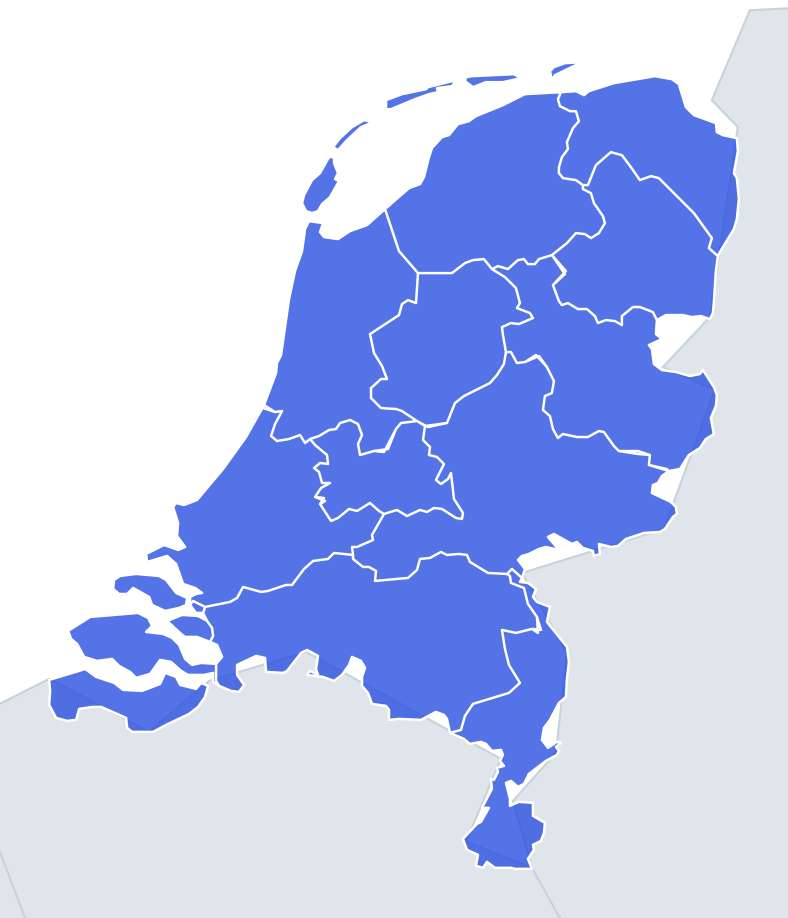
Twelve provincial outlines, shown on their own. Some are instantly recognisable because water shapes them; the inland ones are boxy and need a closer look.
The coastal provinces give themselves away. North Holland is a long finger of land pointing north, with the island of Texel at its tip. Zeeland is a jigsaw of former islands and peninsulas cut by the Eastern and Western Scheldt, plus a strip south of the Western Scheldt, Zeelandic Flanders, that is only joined to the rest by water. Friesland comes with a row of Wadden Islands above it: Vlieland, Terschelling, Ameland and Schiermonnikoog.
The places people miss
- Limburg – the long, thin tail running south between Belgium and Germany. Near Sittard it is only a few kilometres wide.
- Flevoland – two polders with straight engineered edges: the Noordoostpolder attached to the old coast, and the larger Flevopolder as a separate island-like block. Ruler-straight lines mean Flevoland.
- South Holland – a messy outline whose southern part breaks into delta islands such as Goeree-Overflakkee and Voorne-Putten. Do not mix it up with Zeeland, which is further south-west and even more broken up.
- Utrecht – small and irregular, with no sea coast. It looks like a smudge, which is itself the clue.
- Drenthe vs Overijssel – Drenthe is a compact, almost diamond-like block; Overijssel is wider than it is tall and stretches east to the German border.
- Gelderland – the largest province by land area, a wide shape crossed by the Rhine and Waal river belt. It is much broader than the others.
- Groningen – compact, with the Dollard bay biting into its eastern edge.
How to learn it
- Sort the twelve into "water shapes" and "box shapes". The water shapes are North Holland, Zeeland, Friesland, Flevoland and South Holland.
- For the boxes, use size: Gelderland is big, Utrecht is small, North Brabant is a wide horizontal strip along the Belgian border.
- Use Study the map and switch between the full map and single outlines so you see each shape in place before seeing it alone.
- The Mistake Bank will catch Drenthe, Overijssel and Utrecht. Drill those three until you can tell them apart by their edges.
- Done means twelve of twelve in Outlines, then a clean Find on the map run to prove the shapes and positions match.
Guides that help with this
- Oceans, seas, rivers and mountainsThe physical map: seas around each continent, the big rivers and ranges.
- Why you forget countries – and how spaced repetition fixes itThe forgetting curve, and how the Mistake Bank and flashcards use it.
- Flags that look alike (and how to tell them apart)Chad or Romania? Australia or New Zealand? The flag pairs that cost quiz points.
How it works
Each question shows one outline and four names. Similar-sized provinces are mixed in, so it gets tricky.
All 12 provinces in this quiz
Drenthe, Flevoland, Friesland, Gelderland, Groningen, Limburg, North Brabant, North Holland, Overijssel, South Holland, Utrecht, Zeeland.