East Asia outlines quiz
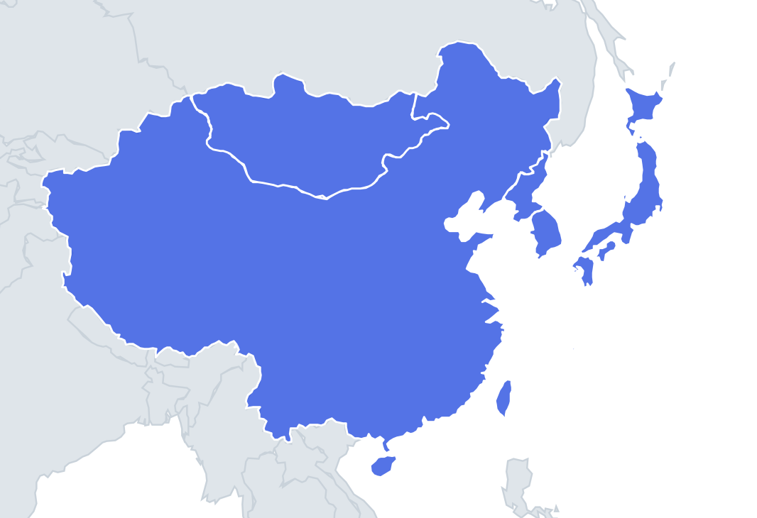
Only the shape is shown, with no map around it. Can you tell which country it is? A great way to really learn East Asia.
Top scores
- The five fastest 100% rounds on this quiz.
Finish with 100% and post your time to get on the board – here or in full screen. All leaderboards
Your next quiz
 West Africa quiz16 countries
 East Africa quiz11 countries
What's on this map
Six outlines, and each has a distinctive shape once you know what to look for. China is the giant, often compared to a rooster: the head and comb are Heilongjiang in the north-east, the tail is Xinjiang in the far west, and the belly runs along the southern border with Vietnam, Laos and Myanmar. Hainan is the small island under its south coast.
Mongolia is a wide, rounded oval with no coastline, like a loaf of bread or a stretched potato. It is about twice as wide as it is tall.
The places people miss
- Japan – a long, curved chain. Hokkaido is the rounded island at the top, Honshu the long curving main island, and Shikoku and Kyushu the two smaller pieces at the south-west end. The Ryukyu islands, including Okinawa, trail away towards Taiwan.
- North Korea – the top half of the peninsula, wider than South Korea at its northern edge where the Yalu and Tumen rivers form the border with China. A tiny stretch of the Tumen also touches Russia.
- South Korea – the bottom half, with a ragged west and south coast full of islands and a smoother east coast. Jeju is the oval island off the south.
- North vs South Korea – the border between them, the Military Demarcation Line from the 1953 armistice, runs diagonally, not straight along the 38th parallel. It is further north on the east coast than on the west.
- Taiwan – a leaf or sweet-potato shape, pointed at the southern end, with mountains along its eastern side. In Taiwan the sweet potato is a popular nickname for the island.
How to learn it
- Use size first: China is huge, Mongolia big, Japan long, and the two Koreas and Taiwan small.
- For the smaller three, look at the edges. A straight-ish diagonal border at the bottom means North Korea; the same line at the top means South Korea. A single island with no land border is Taiwan.
- Remember the rooster for China and the potato for Mongolia.
- Play Study the map with outlines on, then the Outlines quiz. Six shapes should go perfect within two rounds.
- For a harder test, try Chinese provinces or Japanese prefectures outlines next.
Guides that help with this
- Oceans, seas, rivers and mountainsThe physical map: seas around each continent, the big rivers and ranges.
- Why you forget countries – and how spaced repetition fixes itThe forgetting curve, and how the Mistake Bank and flashcards use it.
- Flags that look alike (and how to tell them apart)Chad or Romania? Australia or New Zealand? The flag pairs that cost quiz points.
How it works
Each question shows one outline and four names. Similar-sized countries are mixed in, so it gets tricky.
All 6 countries in this quiz
China, Japan, Mongolia, North Korea, South Korea, Taiwan.