Indian States outlines quiz
Only the shape is shown, with no map around it. Can you tell which state it is? A great way to really learn Indian States.
Top scores
- The five fastest 100% rounds on this quiz.
Finish with 100% and post your time to get on the board – here or in full screen. All leaderboards
Your next quiz
 Chinese Provinces quiz31 provinces
 Japanese Prefectures quiz47 prefectures
What's on this map
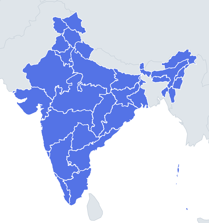
All 36 states and union territories as bare shapes, four names per question. Sizes range from Rajasthan, India's largest state, down to Lakshadweep, a scatter of coral islands smaller than many cities. The quiz mixes in similar-sized options, so the northeastern states are tested against each other and the big states against each other.
Most internal borders were drawn by language, which means they follow old princely and provincial boundaries and are rarely straight. Rivers help with a few: the Godavari and Krishna run through the Deccan, and the Ganges crosses Uttar Pradesh and Bihar. Coastlines are the most useful clue: nine states touch the sea, from Gujarat round to West Bengal.
The places people miss
- Gujarat – look for the two peninsulas: Kutch at the top and the rounded Kathiawar (Saurashtra) below it, separated by the Gulf of Kutch.
- Kerala – a long, thin coastal strip in the far southwest. Nothing else is that narrow and that long.
- Uttar Pradesh vs Madhya Pradesh – both huge. Uttar Pradesh is a long band running along Nepal; Madhya Pradesh is a broad, jagged block in the middle with no coast and no foreign border.
- Goa – tiny and coastal, wedged between Maharashtra and Karnataka.
- Sikkim – a small, compact shape squeezed between Nepal, Bhutan and Tibet.
- Tripura – almost surrounded by Bangladesh, with a narrow link to Assam and Mizoram.
- Puducherry – appears as scattered fragments, because it is made of four separate enclaves.
- Andaman and Nicobar vs Lakshadweep – both island chains. The Andamans are a long north–south line in the Bay of Bengal; Lakshadweep is a few specks in the Arabian Sea.
How to learn it
- Learn the shapes with a feature first: Gujarat's peninsulas, Kerala's strip, Tripura's near-enclave, the island chains.
- Then sort the big inland states by what they touch: Nepal, Bangladesh, or nothing foreign at all.
- Treat the northeast as its own mini-quiz; replay until each shape has a hook.
- Done means 33 or more of 36 in Sudden death.
Guides that help with this
- Oceans, seas, rivers and mountainsThe physical map: seas around each continent, the big rivers and ranges.
- Why you forget countries – and how spaced repetition fixes itThe forgetting curve, and how the Mistake Bank and flashcards use it.
- Flags that look alike (and how to tell them apart)Chad or Romania? Australia or New Zealand? The flag pairs that cost quiz points.
How it works
Each question shows one outline and four names. Similar-sized states & territories are mixed in, so it gets tricky.
All 36 states & territories in this quiz
Andaman and Nicobar Islands, Andhra Pradesh, Arunachal Pradesh, Assam, Bihar, Chandigarh, Chhattisgarh, Dadra and Nagar Haveli and Daman and Diu, Delhi, Goa, Gujarat, Haryana, Himachal Pradesh, Jammu and Kashmir, Jharkhand, Karnataka, Kerala, Ladakh, Lakshadweep, Madhya Pradesh, Maharashtra, Manipur, Meghalaya, Mizoram, Nagaland, Odisha, Puducherry, Punjab, Rajasthan, Sikkim, Tamil Nadu, Telangana, Tripura, Uttar Pradesh, Uttarakhand, West Bengal.