Middle East outlines quiz
Only the shape is shown, with no map around it. Can you tell which country it is? A great way to really learn Middle East.
Top scores
- The five fastest 100% rounds on this quiz.
Finish with 100% and post your time to get on the board – here or in full screen. All leaderboards
Your next quiz
 Central & South Asia quiz13 countries
 Southeast Asia quiz11 countries
What's on this map
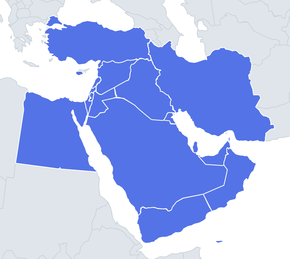
Seventeen Middle Eastern countries shown as lone shapes, with four names per question. The region is mostly desert, so many borders are straight lines drawn across empty land in the 20th century, while coastlines along the Mediterranean, Red Sea, Persian Gulf and Arabian Sea give the shapes their character. Sizes run from Saudi Arabia, over 2 million km², down to Bahrain at under 800 km², but the quiz puts similar sizes side by side.
The places people miss
- Turkey – a long horizontal rectangle, with a small European piece (Thrace) cut off at the northwest by the Bosporus and Dardanelles.
- Egypt – almost a perfect square, with straight western and southern borders. The Sinai Peninsula, a triangle, sticks out at the top right; the Nile does not show in the outline.
- Saudi Arabia – a huge, rounded block covering most of the Arabian Peninsula, with a long Red Sea coast on the west.
- Iraq – a rough heart or pear shape, with only a tiny Gulf coastline at the bottom.
- Jordan – a strange shape with a narrow "panhandle" at the east and a sharp notch on the Saudi border, long said to have been drawn on a map by Winston Churchill. Look for the tiny Red Sea coastline at Aqaba.
- Lebanon – a small, slanted rectangle along the coast.
- Israel – long and narrow, tapering to a sharp point at Eilat in the south.
- Qatar – a thumb-shaped peninsula pointing north into the Gulf.
- Oman – a crescent along the southeast of the peninsula, plus the detached Musandam tip at the Strait of Hormuz.
- United Arab Emirates – a wedge with a long, flat Gulf coast and a jagged eastern edge.
- Cyprus – a pan with a handle: the long Karpas Peninsula points northeast.
- Kuwait – a small, roughly triangular shape at the head of the Gulf.
- Palestine – shown as two separate pieces, the West Bank and the narrow Gaza Strip.
How to learn it
- First recognise the giveaway features: Sinai, Turkey's split, Qatar's thumb, Cyprus's handle, Oman's detached tip, Palestine's two pieces.
- Then compare Iraq, Syria and Jordan side by side in Study the map.
- Done means 17 of 17 in Sudden death.
Guides that help with this
- Oceans, seas, rivers and mountainsThe physical map: seas around each continent, the big rivers and ranges.
- Why you forget countries – and how spaced repetition fixes itThe forgetting curve, and how the Mistake Bank and flashcards use it.
- Flags that look alike (and how to tell them apart)Chad or Romania? Australia or New Zealand? The flag pairs that cost quiz points.
How it works
Each question shows one outline and four names. Similar-sized countries are mixed in, so it gets tricky.
All 17 countries in this quiz
Bahrain, Cyprus, Egypt, Iran, Iraq, Israel, Jordan, Kuwait, Lebanon, Oman, Palestine, Qatar, Saudi Arabia, Syria, Turkey, the United Arab Emirates, Yemen.