Swedish Counties outlines quiz
Only the shape is shown, with no map around it. Can you tell which county it is? A great way to really learn Swedish Counties.
Top scores
- The five fastest 100% rounds on this quiz.
Finish with 100% and post your time to get on the board – here or in full screen. All leaderboards
Your next quiz
 Finnish Regions quiz18 regions
 Polish Voivodeships quiz16 voivodeships
What's on this map
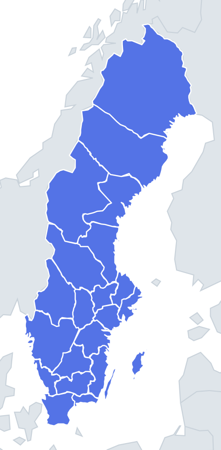
Twenty-one shapes, and their sizes vary enormously. Norrbotten alone covers almost a quarter of Sweden – around 100,000 km², more than Portugal – while Blekinge is only about 3,000 km². Size is therefore your first clue, but the quiz may scale every outline to the same box, so learn the shapes too.
Many county borders follow old provincial lines, rivers and the watershed with Norway, which gives the northern counties long, ragged western edges. Coastal counties have a straight-ish or indented sea edge, while the inland counties – Jämtland, Dalarna, Värmland, Jönköping, Kronoberg, Örebro and Västmanland – have borders all round.
The places people miss
- Gotland – an island shaped a little like a long leaf or a tilted teardrop, with the smaller Fårö off its northern tip. The only county that is entirely an island.
- Västra Götaland – an irregular shape wrapped around the southern end of Lake Vänern. The lake itself leaves a large bite in the outline.
- Västernorrland vs Västerbotten – both coastal and both elongated from the Norwegian mountains to the Gulf of Bothnia. Västerbotten is far longer and touches Norway; Västernorrland is shorter and more compact, and does not reach Norway.
- Blekinge – a narrow, east–west strip of coast, with a deeply indented archipelago shoreline around Karlskrona.
- Halland – a thin strip along the Kattegat coast, much longer than it is wide.
- Stockholm – a jagged shape that is more water than land at its edges, because of its archipelago of tens of thousands of islands.
How to learn it
- Start with the giveaways: Norrbotten (huge, at the top), Gotland (island), Skåne (rounded southern tip) and Halland (thin west-coast strip).
- Then learn the big inland shapes: Jämtland is a broad block against Norway; Dalarna is round with Lake Siljan near its centre.
- Lakes help: Vänern cuts into Värmland and Västra Götaland, Vättern into Jönköping and Östergötland, Mälaren into Stockholm, Uppsala, Västmanland and Södermanland.
- Done is a round where you tell Halland and Blekinge apart at a glance.
Guides that help with this
- Oceans, seas, rivers and mountainsThe physical map: seas around each continent, the big rivers and ranges.
- Why you forget countries – and how spaced repetition fixes itThe forgetting curve, and how the Mistake Bank and flashcards use it.
- Flags that look alike (and how to tell them apart)Chad or Romania? Australia or New Zealand? The flag pairs that cost quiz points.
How it works
Each question shows one outline and four names. Similar-sized counties are mixed in, so it gets tricky.
All 21 counties in this quiz
Blekinge, Dalarna, Gävleborg, Gotland, Halland, Jämtland, Jönköping, Kalmar, Kronoberg, Norrbotten, Örebro, Östergötland, Skåne, Södermanland, Stockholm, Uppsala, Värmland, Västerbotten, Västernorrland, Västmanland, Västra Götaland.