US States outlines quiz
Only the shape is shown, with no map around it. Can you tell which state it is? A great way to really learn US States.
Top scores
- The five fastest 100% rounds on this quiz.
Finish with 100% and post your time to get on the board – here or in full screen. All leaderboards
Your next quiz
 German States quiz16 states
 Austrian States quiz9 states
What's on this map
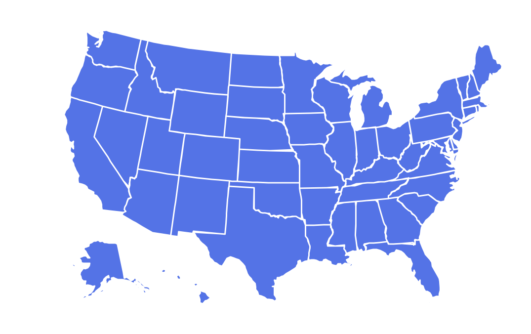
Fifty shapes, and they fall into two families. West of the Mississippi most borders were drawn by surveyors along lines of latitude and longitude in the 1800s, so you get rectangles and near-rectangles: Colorado and Wyoming are almost perfect boxes, and Utah is a box with a notch bitten out of its north-east corner. East of the Mississippi, borders follow rivers, ridges and colonial grants, so the shapes are irregular and far easier to recognise once you have seen them.
Some outlines are famous in their own right. Michigan's Lower Peninsula is a mitten, and locals hold up a hand to show where they live; the Upper Peninsula is a separate piece across the Straits of Mackinac. Florida is the long panhandle and peninsula. Oklahoma has its own panhandle, a thin strip left without a state when Texas, a slave state, gave up its land north of 36°30', the line set by the Missouri Compromise of 1820. Louisiana is a boot, Idaho a chair or gun shape, Nevada a box with its south-west corner sliced off at an angle.
The places people miss
- Colorado vs Wyoming – both rectangles. This is the hardest pair on the quiz: both are about a third wider than they are tall. Rule out the others first, then go with your best guess and let the Mistake Bank sort it out.
- Vermont vs New Hampshire – mirror-image wedges. Vermont is wide at the top and narrow at the bottom; New Hampshire is the opposite, with its narrow end at the top.
- North Dakota vs South Dakota – similar boxes. South Dakota has the Missouri River cutting through its middle and a curved south-east corner; North Dakota is squarer.
- Kentucky vs Tennessee – Tennessee is a long, thin parallelogram; Kentucky is lumpy, with a jagged north border along the Ohio River and a tiny separate piece, the Kentucky Bend, cut off by a loop of the Mississippi.
- Maryland – one of the strangest shapes, almost cut in two by Chesapeake Bay, with a strip at Hancock only about 3 km wide.
How to learn it
- Learn the iconic shapes first: Michigan, Florida, Texas, California, Louisiana, Oklahoma, Idaho.
- Then sort the rectangles by their small quirks, such as Utah's notch and Nevada's sliced corner.
- Finally drill the North-East, where small states hinge on coast and river details.
Guides that help with this
- Oceans, seas, rivers and mountainsThe physical map: seas around each continent, the big rivers and ranges.
- Why you forget countries – and how spaced repetition fixes itThe forgetting curve, and how the Mistake Bank and flashcards use it.
- Flags that look alike (and how to tell them apart)Chad or Romania? Australia or New Zealand? The flag pairs that cost quiz points.
How it works
Each question shows one outline and four names. Similar-sized states are mixed in, so it gets tricky.
All 50 states in this quiz
Alabama, Alaska, Arizona, Arkansas, California, Colorado, Connecticut, Delaware, Florida, Georgia, Hawaii, Idaho, Illinois, Indiana, Iowa, Kansas, Kentucky, Louisiana, Maine, Maryland, Massachusetts, Michigan, Minnesota, Mississippi, Missouri, Montana, Nebraska, Nevada, New Hampshire, New Jersey, New Mexico, New York, North Carolina, North Dakota, Ohio, Oklahoma, Oregon, Pennsylvania, Rhode Island, South Carolina, South Dakota, Tennessee, Texas, Utah, Vermont, Virginia, Washington, West Virginia, Wisconsin, Wyoming.