Brazilian States outlines quiz
Only the shape is shown, with no map around it. Can you tell which state it is? A great way to really learn Brazilian States.
Top scores
- The five fastest 100% rounds on this quiz.
Finish with 100% and post your time to get on the board – here or in full screen. All leaderboards
Your next quiz
 Argentine Provinces quiz24 provinces
 Australian States quiz8 states & territories
What's on this map
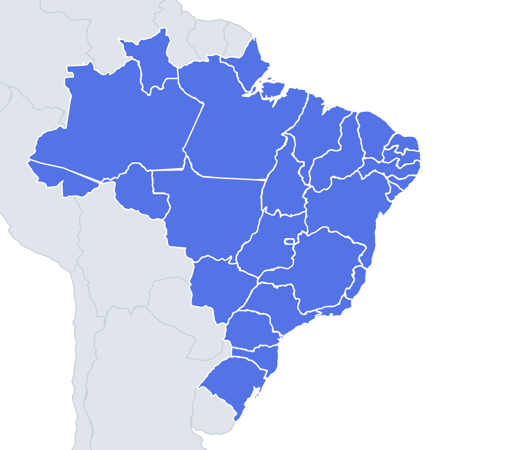
Twenty-seven shapes, from vast Amazonas to the tiny Federal District. Brazil's borders are a mix of rivers in the north and west, straight survey lines across the interior, and the Atlantic coast in the east. Many state borders in the Amazon simply follow rivers, so expect wiggly edges there and ruler-straight ones across the plateau further south.
The easy ones first. Amazonas is the largest state, a huge irregular block in the north-west with the Amazon river system running through it. Bahia is a big, blocky shape with a long coastline facing east. Minas Gerais is a big, lumpy shape with no coast and a long western arm, the Triângulo Mineiro, pointing towards Mato Grosso do Sul. Rio Grande do Sul is a rounded shape at the southern tip, with the Lagoa dos Patos lagoon on its coast.
The places people miss
- Federal District – a small, mostly straight-edged rectangle cut out of Goiás. The smallest shape in the quiz.
- Sergipe – the smallest state, a little triangle on the coast between Bahia and Alagoas.
- Alagoas vs Sergipe – both small coastal pieces. Alagoas is the one on top, and the São Francisco River forms the border between them.
- Tocantins – a long, upright shape between Pará and Bahia, like a tall leaf, with the Araguaia River along its western edge.
- Acre – a wedge in the far west, stretched east to west between Peru, Bolivia and Amazonas.
- Rondônia – a chunky shape in the south-west, with a long curving river border with Bolivia along the Guaporé and Mamoré.
- Pernambuco – a long, thin strip stretching inland from the coast, much wider east to west than north to south.
- Paraná vs Santa Catarina – Paraná is wider and rounder; Santa Catarina is smaller, with a long western arm.
- Rio de Janeiro – a short, curved coastal strip, with Guanabara Bay in the middle of its coast.
How to learn it
- Bank the giants (Amazonas, Pará, Mato Grosso, Bahia, Minas Gerais) and the southern tip (Rio Grande do Sul).
- Learn the Northeast coastal strips in order, from the long thin Pernambuco to the tiny Sergipe.
- Remember Tocantins sits directly on top of Goiás, which it was part of until 1988.
- Similar-sized states are mixed in as wrong answers, so look for the coast before guessing.
Guides that help with this
- Oceans, seas, rivers and mountainsThe physical map: seas around each continent, the big rivers and ranges.
- Why you forget countries – and how spaced repetition fixes itThe forgetting curve, and how the Mistake Bank and flashcards use it.
- Flags that look alike (and how to tell them apart)Chad or Romania? Australia or New Zealand? The flag pairs that cost quiz points.
How it works
Each question shows one outline and four names. Similar-sized states are mixed in, so it gets tricky.
All 27 states in this quiz
Acre, Alagoas, Amapá, Amazonas, Bahia, Ceará, Espírito Santo, Federal District, Goiás, Maranhão, Mato Grosso, Mato Grosso do Sul, Minas Gerais, Pará, Paraíba, Paraná, Pernambuco, Piauí, Rio de Janeiro, Rio Grande do Norte, Rio Grande do Sul, Rondônia, Roraima, Santa Catarina, São Paulo, Sergipe, Tocantins.