Central & Eastern Europe outlines quiz
Only the shape is shown, with no map around it. Can you tell which country it is? A great way to really learn Central & Eastern Europe.
Top scores
- The five fastest 100% rounds on this quiz.
Finish with 100% and post your time to get on the board – here or in full screen. All leaderboards
Your next quiz
 Middle East quiz17 countries
 Central & South Asia quiz13 countries
What's on this map
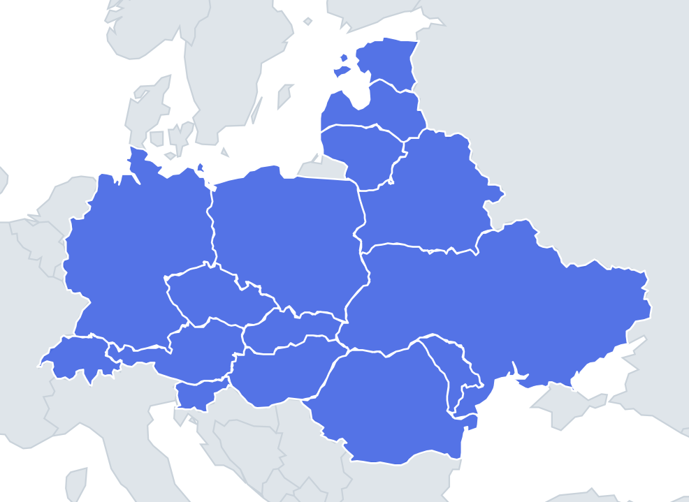
Sixteen shapes, many of them drawn by rivers and mountain ranges. Czechia's old Bohemian core is ringed by mountains – the Ore Mountains, the Sudetes and the Bohemian Forest – which is why its western half (Bohemia) looks like a rounded diamond, with Moravia added on to the east. Romania's outline wraps around the arc of the Carpathians, and its south is the straight-ish line of the Danube. Moldova's western edge follows the Prut, while the Dniester runs through its east, with the thin strip of Transnistria on the far bank.
Some outlines are classic recognitions. Ukraine is a wide shape with the Crimean peninsula hanging into the Black Sea; Crimea was annexed by Russia in 2014, a step Ukraine and most UN members do not recognise, so maps differ, and the quiz shape may or may not include it. Poland is a near-square with a short Baltic coast on top. Germany is a tall, ragged shape that narrows at the top into the base of the Jutland peninsula, where it meets Denmark.
The places people miss
- Slovakia vs Slovenia – Slovakia is a long horizontal shape, wider in the west and tapering to the east. Slovenia is a small chunky shape like a chicken, with a beak of coast on the Adriatic at the bottom left.
- Austria – a long shape with a thin western tail (Tyrol and Vorarlberg) reaching towards Switzerland. People often call it a frying pan or a pipe.
- Hungary – a compact, rounded blob with no coast, bulging slightly to the north-east.
- Estonia, Latvia, Lithuania – Estonia has islands and a squarish body; Latvia is a wide shape with the Gulf of Riga biting into its top; Lithuania is a rounder blob with a short coastline.
- Moldova – a thin, wavy bean standing upright.
- Liechtenstein – a narrow sliver, about 25 km long.
How to learn it
- Learn the easy five first: Germany, Poland, Ukraine, Romania and Switzerland.
- Then pair the confusable shapes and look at them side by side: Slovakia with Slovenia, Hungary with Czechia, Latvia with Lithuania.
- Give each a picture: Austria the frying pan, Slovenia the chicken, Moldova the bean, Czechia the diamond with an extra wing to the east.
- Play Find on the map first so you know which way each country's coast or long edge faces, then do the outline round.
Guides that help with this
- Oceans, seas, rivers and mountainsThe physical map: seas around each continent, the big rivers and ranges.
- Why you forget countries – and how spaced repetition fixes itThe forgetting curve, and how the Mistake Bank and flashcards use it.
- Flags that look alike (and how to tell them apart)Chad or Romania? Australia or New Zealand? The flag pairs that cost quiz points.
How it works
Each question shows one outline and four names. Similar-sized countries are mixed in, so it gets tricky.
All 16 countries in this quiz
Austria, Belarus, Czechia, Estonia, Germany, Hungary, Latvia, Liechtenstein, Lithuania, Moldova, Poland, Romania, Slovakia, Slovenia, Switzerland, Ukraine.