Central & South Asia outlines quiz
Only the shape is shown, with no map around it. Can you tell which country it is? A great way to really learn Central & South Asia.
Top scores
- The five fastest 100% rounds on this quiz.
Finish with 100% and post your time to get on the board – here or in full screen. All leaderboards
Your next quiz
 Southeast Asia quiz11 countries
 East Asia quiz6 countries
What's on this map
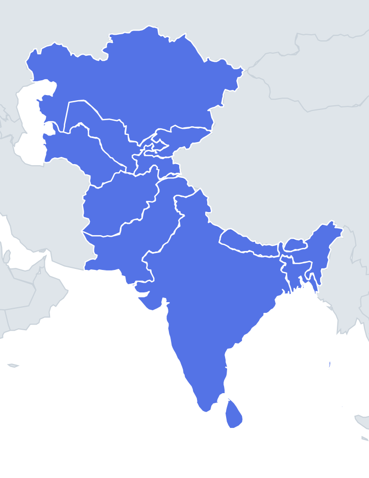
Thirteen shapes, from the vast to the tiny. India is the easiest: the great triangle of the peninsula pointing south into the Indian Ocean, with a wider northern body and the north-eastern states joined on by the narrow Siliguri Corridor, sometimes called the "chicken's neck". Kazakhstan is a huge, wide block stretching from the Caspian Sea to China. Sri Lanka is a teardrop or pear hanging off India's southern tip.
The difficult ones are in Central Asia, where Soviet border-drawing produced odd outlines. Kyrgyzstan, Uzbekistan and Tajikistan interlock around the Fergana Valley, so each has a strange notch or arm where the valley is shared out.
The places people miss
- Afghanistan – a rough leaf with a long thin finger, the Wakhan Corridor, pointing east to China. If you see the finger, it is Afghanistan.
- Tajikistan – a small shape with a big eastern lump (the Pamir mountains) and a thin northern arm reaching into the Fergana Valley.
- Kyrgyzstan – a wider oval with a deep bite out of its western side, where the Fergana Valley belongs to Uzbekistan.
- Uzbekistan – a long sprawling shape running from the Aral Sea in the west to a narrow eastern tail in the Fergana Valley.
- Turkmenistan – a broad shape with a long Caspian coast on its west side and Iran along its southern edge.
- Nepal vs Bhutan – Nepal is a long, slanting rectangle; Bhutan is a small, compact blob.
- Bangladesh – a shape with a ragged southern edge where the Ganges delta meets the Bay of Bengal.
- Maldives – a chain of tiny atolls; the outline is just a scatter of dots running north to south.
How to learn it
- Learn the four easy shapes first: India, Kazakhstan, Sri Lanka and Pakistan (a tall, diagonal shape running from the Arabian Sea up to the Karakoram).
- Learn the Wakhan Corridor and the Fergana Valley, because they explain most of the hard outlines.
- Compare Kyrgyzstan and Tajikistan side by side: the one with a notch out of its west is Kyrgyzstan; the one with an arm going north is Tajikistan.
- Play Find on the map first so you know where each shape sits, then do the outline round.
Guides that help with this
- Oceans, seas, rivers and mountainsThe physical map: seas around each continent, the big rivers and ranges.
- Why you forget countries – and how spaced repetition fixes itThe forgetting curve, and how the Mistake Bank and flashcards use it.
- Flags that look alike (and how to tell them apart)Chad or Romania? Australia or New Zealand? The flag pairs that cost quiz points.
How it works
Each question shows one outline and four names. Similar-sized countries are mixed in, so it gets tricky.
All 13 countries in this quiz
Afghanistan, Bangladesh, Bhutan, India, Kazakhstan, Kyrgyzstan, the Maldives, Nepal, Pakistan, Sri Lanka, Tajikistan, Turkmenistan, Uzbekistan.