East Africa outlines quiz
Only the shape is shown, with no map around it. Can you tell which country it is? A great way to really learn East Africa.
Top scores
- The five fastest 100% rounds on this quiz.
Finish with 100% and post your time to get on the board – here or in full screen. All leaderboards
Your next quiz
 Southern Africa quiz14 countries
 Caribbean quiz13 countries
What's on this map
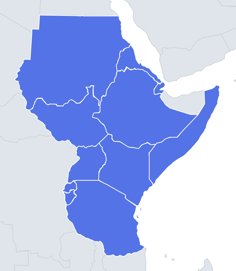
Eleven East African outlines, shown on their own. A few are among Africa's most recognisable shapes; others need a second clue.
The famous one is Somalia, shaped like a number 7 or a boomerang: a long coast running north-east to the tip at Cape Guardafui, the point of the Horn of Africa, then bending sharply west along the Gulf of Aden. Eritrea is a long, thin strip along the Red Sea that widens at its northern end, a bit like a funnel. Ethiopia is a large, rounded shape with a big wedge, the Ogaden, pushing south-east into the bend of Somalia's 7.
The places people miss
- Djibouti – small and shaped like a crab claw around the Gulf of Tadjoura, which bites deep into the country from the east.
- Rwanda vs Burundi – both are small and roughly square. Rwanda is slightly rounder, with Lake Kivu along its western edge; Burundi is a little more pointed at the bottom and has a straight-edged western side along Lake Tanganyika and the Rusizi river.
- Uganda – a near-square whose southern border with Tanzania follows a straight line of latitude, much of it through Lake Victoria.
- Kenya – a long straight edge with Somalia on the east, a diagonal border with Tanzania in the south-west, a short coastline in the south-east and a small pocket at the top left near the Ilemi Triangle.
- Tanzania – a big shape with the angled northern border it shares with Kenya, straight lines inherited from British–German treaties of the 1880s and 1890s. Zanzibar and Pemba sit offshore.
- Sudan vs South Sudan – Sudan is large with a long straight edge along Egypt (the 22nd parallel) and the Red Sea coast on the right. South Sudan is landlocked and much smaller, with a jagged southern edge.
How to learn it
- Start with the three shapes everyone knows: Somalia's 7, Eritrea's strip and Tanzania with its islands.
- Look for coastlines: Sudan, Eritrea, Djibouti, Somalia, Kenya and Tanzania have one; Ethiopia, South Sudan, Uganda, Rwanda and Burundi do not.
- For the small pair, remember that Rwanda is the one bordering Uganda, so its northern edge lines up with Uganda's southern corner.
- Play Study the map with outlines, then let the Mistake Bank drill Rwanda and Burundi.
- Done means 11 of 11 in Outlines twice in a row.
Guides that help with this
- Oceans, seas, rivers and mountainsThe physical map: seas around each continent, the big rivers and ranges.
- Why you forget countries – and how spaced repetition fixes itThe forgetting curve, and how the Mistake Bank and flashcards use it.
- Flags that look alike (and how to tell them apart)Chad or Romania? Australia or New Zealand? The flag pairs that cost quiz points.
How it works
Each question shows one outline and four names. Similar-sized countries are mixed in, so it gets tricky.
All 11 countries in this quiz
Burundi, Djibouti, Eritrea, Ethiopia, Kenya, Rwanda, Somalia, South Sudan, Sudan, Tanzania, Uganda.