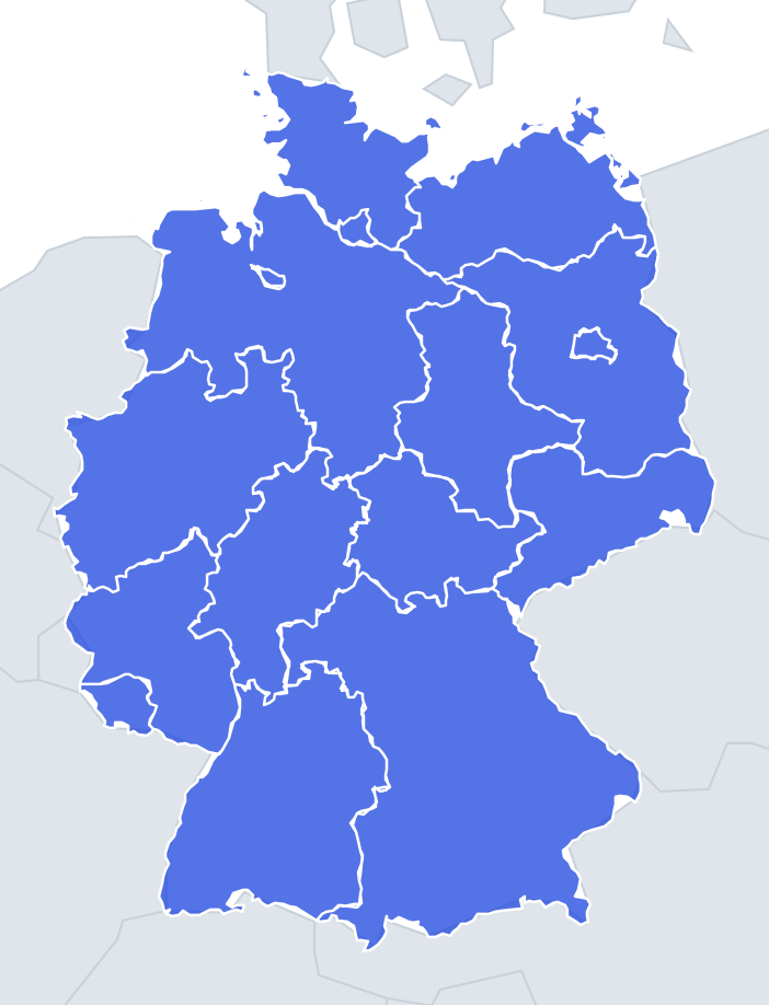
German States outlines quiz
Only the shape is shown, with no map around it. Can you tell which state it is? A great way to really learn German States.
Top scores
- The five fastest 100% rounds on this quiz.
Finish with 100% and post your time to get on the board – here or in full screen. All leaderboards
Your next quiz
 Austrian States quiz9 states
 Swiss Cantons quiz26 cantons
What's on this map
Each of the 16 German states appears as a lone shape, with four names to choose from. The wrong answers are states of a similar size, so Bavaria will not be hiding among the city-states. The size gap is huge: Bavaria covers about a fifth of Germany, while Bremen is under 1 percent of Bavaria's area.
The best clues are water and borders. Schleswig-Holstein and Mecklenburg-Western Pomerania touch the Baltic, while Lower Saxony and Schleswig-Holstein touch the North Sea. Rivers form many internal borders: the Rhine runs along the edges of Baden-Württemberg and Rhineland-Palatinate, and the Elbe forms parts of the borders of Lower Saxony, Brandenburg and Schleswig-Holstein. Shapes with a hole in them are the giveaway for states that surround another state.
The places people miss
- Brandenburg – a ring with a hole in the middle, because Berlin is cut out of it. No other state has a hole that big.
- Lower Saxony – a big shape with the East Frisian Islands strung along its northern coast and a small hole where the city of Bremen sits.
- Bremen – two pieces, not one: the city and the port of Bremerhaven at the mouth of the Weser.
- Schleswig-Holstein – a narrow neck of land between the North Sea and the Baltic, with a short east–west land border against Denmark and islands on both sides.
- Mecklenburg-Western Pomerania – a long Baltic strip ending in Rügen, Germany's largest island, and Usedom on the Polish border.
- Baden-Württemberg – the Rhine forms its western and southern edges, and Lake Constance takes a bite out of the bottom.
- Saarland vs Hamburg vs Berlin – the three small ones. Saarland is irregular with a French border; Berlin is a fairly round blob; Hamburg is lopsided along the Elbe.
How to learn it
- Learn the "special features" first: the doughnut, the two-piece state, the two islands, the lake.
- Then use the coasts to sort out the northern four.
- Run Find on the map between Outlines rounds so you remember what each shape borders.
- Done means 16 of 16 in Sudden death.
Guides that help with this
- Oceans, seas, rivers and mountainsThe physical map: seas around each continent, the big rivers and ranges.
- Why you forget countries – and how spaced repetition fixes itThe forgetting curve, and how the Mistake Bank and flashcards use it.
- Flags that look alike (and how to tell them apart)Chad or Romania? Australia or New Zealand? The flag pairs that cost quiz points.
How it works
Each question shows one outline and four names. Similar-sized states are mixed in, so it gets tricky.
All 16 states in this quiz
Baden-Württemberg, Bavaria, Berlin, Brandenburg, Free Hanseatic Bremen, Hamburg, Hesse, Lower Saxony, Mecklenburg-Western Pomerania, North Rhine-Westphalia, Rhineland-Palatinate, Saarland, Saxony, Saxony-Anhalt, Schleswig-Holstein, Thuringia.