Mexican States outlines quiz
Only the shape is shown, with no map around it. Can you tell which state it is? A great way to really learn Mexican States.
Top scores
- The five fastest 100% rounds on this quiz.
Finish with 100% and post your time to get on the board – here or in full screen. All leaderboards
Your next quiz
 Brazilian States quiz27 states
 Argentine Provinces quiz24 provinces
What's on this map
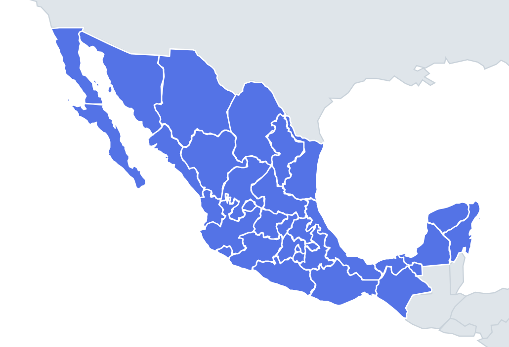
All 32 of Mexico's federal entities as lone shapes, four names per question. Size helps a little – Chihuahua is the largest state and Mexico City the smallest, more than 150 times smaller – but the quiz pairs similar sizes, so you need to read the edges.
The northern states share the US border, which runs as long straight surveyed lines west of El Paso and then follows the Rio Grande (Río Bravo) east to the Gulf. A state with a long ruler-straight edge on top is Sonora or Chihuahua; one with a wiggly river edge is Coahuila, Nuevo León or Tamaulipas (Chihuahua has both). Coastlines are the other big clue: Mexico has a long Pacific side and a Gulf of Mexico side, and the Yucatán peninsula faces the Caribbean.
The places people miss
- Baja California vs Baja California Sur – the peninsula is split in two at the 28th parallel, so both shapes have a dead-straight east–west line where they meet. The northern one has that line at the bottom; the southern one at the top, and it ends in a pointed tip at Cabo San Lucas.
- Yucatán, Campeche, Quintana Roo – the peninsula is divided into three. Yucatán is the northern triangle, Campeche the western strip on the Gulf, Quintana Roo the long eastern strip on the Caribbean.
- Nuevo León – a thin, irregular shape with a narrow finger reaching north to touch a short stretch of the US border.
- Veracruz – a long, thin crescent along the Gulf coast, the most stretched shape on the map.
- Mexico City – a small blob, almost entirely surrounded by the State of Mexico, with Morelos touching its southern edge.
- State of Mexico – a horseshoe wrapped around Mexico City; look for the hole.
- Morelos vs Tlaxcala – both small and inland. Morelos is a compact square-ish block south of the capital; Tlaxcala is a small irregular shape tucked into Puebla.
How to learn it
- Start with the distinctive ones: the two Bajas, the three Yucatán states, Veracruz's crescent, the State of Mexico's hole.
- Then sort northern states by straight versus river border.
- Done means 29 or more of 32 in Sudden death.
Guides that help with this
- Oceans, seas, rivers and mountainsThe physical map: seas around each continent, the big rivers and ranges.
- Why you forget countries – and how spaced repetition fixes itThe forgetting curve, and how the Mistake Bank and flashcards use it.
- Flags that look alike (and how to tell them apart)Chad or Romania? Australia or New Zealand? The flag pairs that cost quiz points.
How it works
Each question shows one outline and four names. Similar-sized states are mixed in, so it gets tricky.
All 32 states in this quiz
Aguascalientes, Baja California, Baja California Sur, Campeche, Chiapas, Chihuahua, Coahuila, Colima, Durango, Guanajuato, Guerrero, Hidalgo, Jalisco, Mexico City, Michoacán, Morelos, Nayarit, Nuevo León, Oaxaca, Puebla, Querétaro, Quintana Roo, San Luis Potosí, Sinaloa, Sonora, State of Mexico, Tabasco, Tamaulipas, Tlaxcala, Veracruz, Yucatán, Zacatecas.