Name all 37 Nigerian States
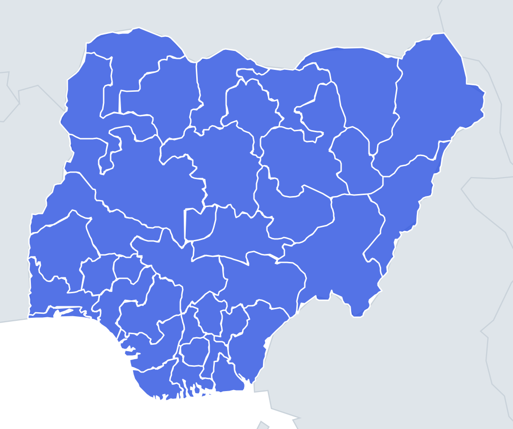
No map hints and no multiple choice: just type every one you can remember. Each correct answer lights up on the map, and the clock keeps running until you give up or get all 37.
Top scores
- The five fastest 100% rounds on this quiz.
Finish with 100% and post your time to get on the board – here or in full screen. All leaderboards
Your next quiz
 Danish Regions quiz5 regions
 Danish Municipalities quiz98 municipalities
What's on this map
Thirty-six states and the Federal Capital Territory, typed from memory. Nigeria did not always look like this. At independence in 1960 it had three regions – Northern, Western and Eastern – and a Mid-Western Region was added in 1963. In 1967 the regions were replaced by 12 states, then came 19 in 1976, 21 in 1987, 30 in 1991 and finally 36 in 1996. The six newest, from 1996, are the ones people forget: Bayelsa, Ebonyi, Ekiti, Gombe, Nasarawa and Zamfara.
Many states are named after rivers, which is a useful prompt: Niger, Benue, Rivers, Cross River, Delta, Ogun, Osun, Kaduna, Anambra, Imo, Yobe and Taraba all take their name from water. Kwara comes from a local name for the Niger itself.
An alphabetical sweep works well because the letters are lopsided. A gives four (Abia, Adamawa, Akwa Ibom, Anambra), B four (Bauchi, Bayelsa, Benue, Borno), E four (Ebonyi, Edo, Ekiti, Enugu), K six (Kaduna, Kano, Katsina, Kebbi, Kogi, Kwara) and O four (Ogun, Ondo, Osun, Oyo). Everything else is one or two per letter.
The places people miss
- Nasarawa – spelled with one "s" in the middle and "-rawa" at the end; Nassarawa is wrong.
- Akwa Ibom – two words, no hyphen.
- Federal Capital Territory – not a state, but it counts here; type it in full.
- Ebonyi – often mistyped as "Ebony".
- Jigawa and Zamfara – northern states carved out in the 1990s, missing from older maps.
- Kebbi vs Kogi – both K, both short; one is in the far northwest, the other at the Niger–Benue confluence.
How to learn it
- Type alphabetically and count each letter's total: A4, B4, C1, D1, E4, F1, G1, I1, J1, K6, L1, N2, O4, P1, R1, S1, T1, Y1, Z1.
- If you stall, run the river names – a dozen states come back at once.
- Then cross-check by zone: seven northwestern states, six northeastern, the middle belt, five southwestern plus Lagos, the Igbo southeast and the Delta.
- Drill the six 1996 states as a group until they feel as familiar as Lagos and Kano.
- Done means 37 of 37 typed before the clock runs out.
Guides that help with this
- Oceans, seas, rivers and mountainsThe physical map: seas around each continent, the big rivers and ranges.
- Why you forget countries – and how spaced repetition fixes itThe forgetting curve, and how the Mistake Bank and flashcards use it.
- Flags that look alike (and how to tell them apart)Chad or Romania? Australia or New Zealand? The flag pairs that cost quiz points.
How it works
Type a name and press enter. Spelling is forgiving: accents, capital letters and common alternative names are all accepted. When you stop, the ones you missed are shown on the map so you know which to practise next time.
Most people get well under half on the first try. Play the map quiz a few times first, then come back and see how many you can name.
Answer list (37 states)
Show all 37 answers (spoilers)
- Abia State
- Adamawa State
- Akwa Ibom State
- Anambra State
- Bauchi State
- Bayelsa State
- Benue State
- Borno State
- Cross River State
- Delta State
- Ebonyi State
- Edo State
- Ekiti State
- Enugu State
- Federal Capital Territory
- Gombe State
- Imo State
- Jigawa State
- Kaduna State
- Kano State
- Katsina State
- Kebbi State
- Kogi State
- Kwara State
- Lagos
- Nasarawa State
- Niger State
- Ogun State
- Ondo State
- Osun State
- Oyo State
- Plateau State
- Rivers State
- Sokoto State
- Taraba State
- Yobe State
- Zamfara State