South African Provinces outlines quiz
Only the shape is shown, with no map around it. Can you tell which province it is? A great way to really learn South African Provinces.
Top scores
- The five fastest 100% rounds on this quiz.
Finish with 100% and post your time to get on the board – here or in full screen. All leaderboards
Your next quiz
 Nigerian States quiz37 states
 Danish Regions quiz5 regions
What's on this map
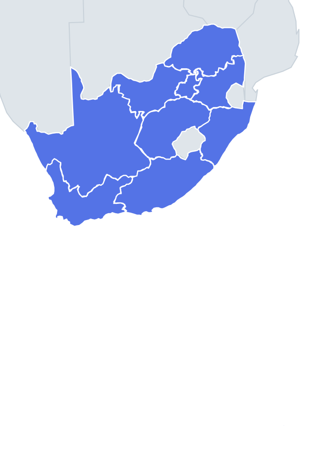
Nine provinces shown one at a time as shapes. Size helps more than usual here because the differences are extreme: Northern Cape covers almost a third of South Africa, while Gauteng is under 2 per cent of the country – yet Gauteng has the largest population. Rivers, coasts and neighbouring countries give the rest.
The Orange River is the main clue in the west. It forms the border with Namibia and runs across Northern Cape, which is why that province has a long, wavy northern edge. The Vaal River separates Free State from Gauteng and North West, giving Free State a curving northern side. The Limpopo River forms the northern border with Botswana and Zimbabwe, the top edge of Limpopo province.
Two provinces are shaped by Lesotho. Free State wraps around Lesotho's north-western side, so it has a big scoop missing on its south-east. KwaZulu-Natal and Eastern Cape both touch Lesotho from the other sides. Mpumalanga has a notch on its eastern side where Eswatini sits.
The places people miss
- Gauteng – a small, compact blob with no coast and no international border; the only province that touches neither.
- Free State – look for the Lesotho-shaped bite in the south-east and the curved Vaal River edge on top.
- KwaZulu-Natal – a long Indian Ocean coastline on the right, the Drakensberg escarpment on the left, and Eswatini and Mozambique at the top.
- Mpumalanga vs Limpopo – Limpopo is wider, with a flat northern river border; Mpumalanga is smaller and has the Eswatini notch.
- North West – an irregular shape with a ragged northern edge along Botswana and no coast.
- Eastern Cape vs Western Cape – both coastal. Western Cape has the Cape Peninsula at the bottom left and two oceans; Eastern Cape faces only the Indian Ocean and reaches Lesotho.
How to learn it
- Sort shapes into coastal (Western Cape, Eastern Cape, Northern Cape, KwaZulu-Natal) and inland (the other five).
- For the inland five, use the borders: Lesotho means Free State, Eswatini means Mpumalanga, Zimbabwe means Limpopo, Botswana alone means North West, nothing at all means Gauteng.
- Use Study the map once to see each province in place, then repeat until clean.
- Done means 9 of 9 correct in one run.
Guides that help with this
- Oceans, seas, rivers and mountainsThe physical map: seas around each continent, the big rivers and ranges.
- Why you forget countries – and how spaced repetition fixes itThe forgetting curve, and how the Mistake Bank and flashcards use it.
- Flags that look alike (and how to tell them apart)Chad or Romania? Australia or New Zealand? The flag pairs that cost quiz points.
How it works
Each question shows one outline and four names. Similar-sized provinces are mixed in, so it gets tricky.
All 9 provinces in this quiz
Eastern Cape, Free State, Gauteng, KwaZulu-Natal, Limpopo, Mpumalanga, North West, Northern Cape, Western Cape.