South America outlines quiz
Only the shape is shown, with no map around it. Can you tell which country it is? A great way to really learn South America.
Top scores
- The five fastest 100% rounds on this quiz.
Finish with 100% and post your time to get on the board – here or in full screen. All leaderboards
Your next quiz
 Countries of the World quiz197 countries
 Oceania quiz14 countries
What's on this map
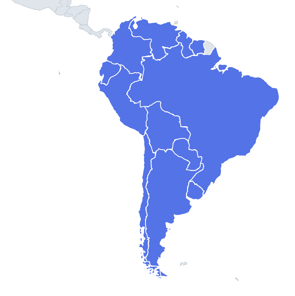
Twelve shapes, and several are among the most recognisable outlines on Earth. Chile is the one nobody misses: a ribbon about 4,300 km long but rarely more than 350 km wide, squeezed between the Andes and the Pacific. Brazil is the giant with the bulge into the Atlantic, its eastern corner pointing towards Africa. Argentina is the long tapering wedge that shares the island of Tierra del Fuego with Chile at the southern end.
The difficult outlines are the medium and small ones in the middle and north, where only a few details separate one blob from another. Look for coastlines, rivers and odd corners rather than the overall size, because the quiz may scale every shape to fill the same box.
The places people miss
- Colombia – the only South American country with coasts on both the Caribbean and the Pacific. Look for the Guajira peninsula pointing up at the top and a thin finger in the south that reaches the Amazon River at Leticia.
- Bolivia – a chunky, landlocked block with a jagged western edge. It lost its coastline to Chile in the War of the Pacific (1879–1884), so the outline has no sea side at all.
- Paraguay – a landlocked shape whose borders follow rivers for long stretches: the Paraguay, the Paraná and the Pilcomayo. The Paraguay River also splits it into the dry Chaco in the north-west and the greener east.
- Guyana vs Suriname – Guyana is taller and thinner, stretching inland from the coast; Suriname is more compact and almost square.
- Uruguay – a small rounded shape with a coast on two sides, the Atlantic and the wide estuary of the Río de la Plata.
How to learn it
- Sort the shapes into three groups: thin (Chile), huge (Brazil, Argentina) and everything else, then work only on the last group.
- For each middle-sized country, learn one feature: Ecuador is small and compact on the Pacific, Peru has a long coast running north-west to south-east, Venezuela has the bite of the Gulf of Venezuela and Lake Maracaibo in its west.
- Switch to Find on the map after a wrong answer; seeing the shape in place fixes it faster than repeating the outline.
- Done is a clean round with no second guess on Paraguay or Guyana.
Guides that help with this
- Oceans, seas, rivers and mountainsThe physical map: seas around each continent, the big rivers and ranges.
- Why you forget countries – and how spaced repetition fixes itThe forgetting curve, and how the Mistake Bank and flashcards use it.
- Flags that look alike (and how to tell them apart)Chad or Romania? Australia or New Zealand? The flag pairs that cost quiz points.
How it works
Each question shows one outline and four names. Similar-sized countries are mixed in, so it gets tricky.
All 12 countries in this quiz
Argentina, Bolivia, Brazil, Chile, Colombia, Ecuador, Guyana, Paraguay, Peru, Suriname, Uruguay, Venezuela.