Spanish Regions outlines quiz
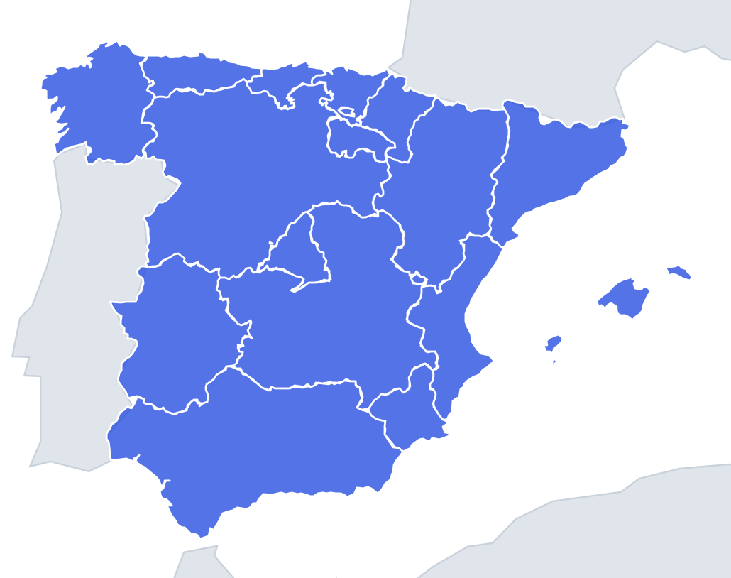
Only the shape is shown, with no map around it. Can you tell which region it is? A great way to really learn Spanish Regions.
Top scores
- The five fastest 100% rounds on this quiz.
Finish with 100% and post your time to get on the board – here or in full screen. All leaderboards
Your next quiz
 Italian Regions quiz20 regions
 Canadian Provinces quiz13 provinces & territories
What's on this map
Sixteen shapes, from Castile and León, one of the largest regions in Europe at about 94,000 km², to the tiny wedge of La Rioja. Some are easy giveaways: the Balearic Islands are a cluster of four main islands, Madrid is a small, roughly triangular shape in the middle of the country, and Andalusia is the long, wide shape stretched across the whole south, with coasts on both the Atlantic and the Mediterranean.
The difficulty lies in the inland regions, which have no coastline to give them away, and the small northern regions, which are often thin strips. Look at the length-to-width ratio, the number of coasts and any odd notches.
The places people miss
- Castile and León vs Castilla-La Mancha – both large and inland. Castile and León is the bigger and more blocky one with a ragged northern edge; Castilla-La Mancha is wider than tall and has a notch where Madrid cuts into its northern side.
- Madrid – often compared to a heart or a triangle. It fits like a puzzle piece between the two Castiles, with no border on any other region.
- Cantabria – a short, wide strip on the north coast. It also contains an exclave: the Valle de Villaverde, enclosed between the Basque province of Biscay and the province of Burgos.
- La Rioja – small and elongated east to west, following the Ebro valley. Much of its northern edge follows the river.
- Valencia – a long thin crescent down the Mediterranean coast. Inland it contains the Rincón de Ademuz, an exclave between Castilla-La Mancha and Aragon.
- Murcia – compact and roughly square, with a short coast including the lagoon of the Mar Menor.
How to learn it
- Learn the four giveaways first: Andalusia, Balearic Islands, Madrid and Catalonia, a triangle in the north-east corner.
- Next the coast strips: Galicia (square with a jagged Atlantic edge), Asturias, Cantabria and the small Basque Country.
- Then the inland giants by shape: Aragon is a tall north–south rectangle; Extremadura is a square block on the Portuguese border.
- Done is a full round without confusing the two Castiles.
Guides that help with this
- Oceans, seas, rivers and mountainsThe physical map: seas around each continent, the big rivers and ranges.
- Why you forget countries – and how spaced repetition fixes itThe forgetting curve, and how the Mistake Bank and flashcards use it.
- Flags that look alike (and how to tell them apart)Chad or Romania? Australia or New Zealand? The flag pairs that cost quiz points.
How it works
Each question shows one outline and four names. Similar-sized regions are mixed in, so it gets tricky.
All 16 regions in this quiz
Andalusia, Aragon, Asturias, Balearic Islands, Basque Country, Cantabria, Castile and León, Castilla-La Mancha, Catalonia, Extremadura, Galicia, La Rioja, Madrid, Murcia, Navarre, Valencia.