Canadian Provinces quiz
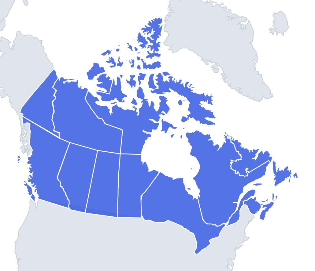
Can you find all 13 provinces & territories on the map? Tap the right place, see how fast you can reach 100%, and practise the ones you missed until you know them all.
Top scores
- The five fastest 100% rounds on this quiz.
Finish with 100% and post your time to get on the board – here or in full screen. All leaderboards
Your next quiz
 Mexican States quiz32 states
 Brazilian States quiz27 states
What's on this map
Ten provinces and three territories, laid out in two rows. The southern row runs west to east: British Columbia, Alberta, Saskatchewan, Manitoba, Ontario, Quebec, then the four Atlantic provinces of New Brunswick, Nova Scotia, Prince Edward Island and Newfoundland and Labrador. The northern row is the three territories, also west to east: Yukon, Northwest Territories, Nunavut.
The three prairie provinces in the middle are near-rectangles and are easiest to learn as a block. Ontario and Quebec are the two giants wrapped around Hudson Bay and the St Lawrence. Nunavut includes most of the Arctic islands, which is why it looks enormous.
Start from British Columbia and Newfoundland at the two ends, then fill in the middle row before the territories.
The ones people miss
- New Brunswick vs Nova Scotia – New Brunswick is on the mainland touching Quebec and Maine; Nova Scotia is the peninsula hanging off it.
- Prince Edward Island – the small island in the gulf north of Nova Scotia; capital Charlottetown.
- Newfoundland and Labrador – the island is Newfoundland, but the province also owns Labrador on the mainland north of Quebec; St. John's is on the island.
- Nunavut vs Northwest Territories – Nunavut is the eastern one with the islands, capital Iqaluit on Baffin Island; Yellowknife is in the NWT.
- British Columbia's capital – Victoria, on Vancouver Island, not Vancouver.
- Alberta's capital – Edmonton, not Calgary.
- Saskatchewan's capital – Regina, not Saskatoon.
How to learn it
- One Study the map pass is enough to fix the two rows.
- Find on the map should be a quick 13 of 13; spend your time on Capitals instead.
- Put the five trap capitals (Victoria, Edmonton, Regina, Québec, Iqaluit) and the Atlantic four in flashcards.
- Outlines mode is good practice because Nova Scotia, Newfoundland and Saskatchewan are instantly recognisable shapes.
- Done means a perfect Capitals round and a perfect sudden-death streak.
Guides that help with this
- Why you forget countries – and how spaced repetition fixes itThe forgetting curve, and how the Mistake Bank and flashcards use it.
- Using Quiz the Map in the classroomWhich quizzes fit which age, live class games, printable maps.
- Flags that look alike (and how to tell them apart)Chad or Romania? Australia or New Zealand? The flag pairs that cost quiz points.
How to play
A name appears at the top. Tap that place on the map. You get three tries: green means first try, yellow second and orange third. After three misses the right place flashes. Tiny places get a circle so they are easy to hit, and you can zoom with two fingers or the mouse wheel.
Want a harder test? Try Name them all (type every province you can remember before the clock runs out) or Sudden death (one mistake and the game is over).
All 13 provinces & territories
| Province | Capital |
|---|---|
| Alberta | Edmonton |
| British Columbia | Victoria |
| Manitoba | Winnipeg |
| New Brunswick | Fredericton |
| Newfoundland and Labrador | St. John's |
| Northwest Territories | Yellowknife |
| Nova Scotia | Halifax |
| Nunavut | Iqaluit |
| Ontario | Toronto |
| Prince Edward Island | Charlottetown |
| Quebec | Québec |
| Saskatchewan | Regina |
| Yukon | Whitehorse |