Swiss Cantons outlines quiz
Only the shape is shown, with no map around it. Can you tell which canton it is? A great way to really learn Swiss Cantons.
Top scores
- The five fastest 100% rounds on this quiz.
Finish with 100% and post your time to get on the board – here or in full screen. All leaderboards
Your next quiz
 Swedish Counties quiz21 counties
 Finnish Regions quiz18 regions
What's on this map
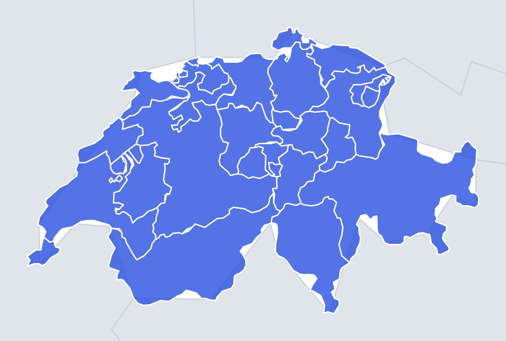
Twenty-six shapes, from Grisons, at about 7,100 km² the largest canton and covering about a sixth of Switzerland, to Basel-Stadt at about 37 km². Because the quiz may enlarge each shape, the tiny cantons can look as big as the giants, so you need to know their outlines, not just their size.
Many cantons have strange shapes because their borders were set by medieval lordships, monasteries and city territories rather than by geography. Several have exclaves – detached pieces surrounded by another canton – and these are your best clues.
The places people miss
- Fribourg – a fragmented shape with several exclaves inside Vaud, plus enclaves of Vaud inside it.
- Solothurn – one of the oddest outlines in Switzerland: a long, twisted shape with arms reaching north, and two exclaves on the French border near Basel.
- Schaffhausen – three separate pieces, mostly north of the Rhine and largely surrounded by Germany.
- Ticino – a triangle pointing south into Italy, with Lake Lugano and Lake Maggiore cutting into its southern part.
- Valais – a long east–west valley shape that follows the Rhône from its glacier source to Lake Geneva. Memory hook: the side valleys branch off it like the bones of a fish.
- Geneva – a small shape almost surrounded by France, joined to the rest of Switzerland only by a short stretch of border with Vaud.
- Bern – a tall shape running from the Jura mountains in the north to the Alps in the south, narrowing in the middle.
How to learn it
- Learn the giveaways first: Grisons (large and many-sided), Valais (the long valley), Ticino (the southern triangle), Geneva (the western tip).
- Then the shapes with pieces: Schaffhausen, Solothurn and Fribourg.
- Leave the central cluster – Lucerne, Zug, Schwyz, Uri, Obwalden, Nidwalden, Glarus – for last, and learn each by its lake: Zug and Lucerne by their lakes, Uri by the long southern arm of Lake Lucerne.
- Done is a round without confusing Obwalden and Nidwalden.
Guides that help with this
- Oceans, seas, rivers and mountainsThe physical map: seas around each continent, the big rivers and ranges.
- Why you forget countries – and how spaced repetition fixes itThe forgetting curve, and how the Mistake Bank and flashcards use it.
- Flags that look alike (and how to tell them apart)Chad or Romania? Australia or New Zealand? The flag pairs that cost quiz points.
How it works
Each question shows one outline and four names. Similar-sized cantons are mixed in, so it gets tricky.
All 26 cantons in this quiz
Aargau, Appenzell Ausserrhoden, Appenzell Innerrhoden, Basel-Landschaft, Basel-Stadt, Bern, Fribourg, Geneva, Glarus, Grisons, Jura, Lucerne, Neuchâtel, Nidwalden, Obwalden, Schaffhausen, Schwyz, Solothurn, St. Gallen, Thurgau, Ticino, Uri, Valais, Vaud, Zug, Zürich.