Canadian Provinces outlines quiz
Only the shape is shown, with no map around it. Can you tell which province it is? A great way to really learn Canadian Provinces.
Top scores
- The five fastest 100% rounds on this quiz.
Finish with 100% and post your time to get on the board – here or in full screen. All leaderboards
Your next quiz
 Mexican States quiz32 states
 Brazilian States quiz27 states
What's on this map
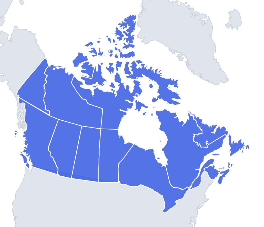
Thirteen shapes, from the near-perfect rectangles of the prairies to the shattered islands of the Arctic. Many of Canada's internal borders were drawn as the country grew between 1867 and 1999, and a lot of them are straight lines on lines of longitude and latitude. The 60th parallel is the most important: it separates the four western provinces from the three territories along one straight line.
The prairies are the easy part. Saskatchewan is almost a perfect rectangle, slightly narrower at the top. Alberta has a straight eastern and northern edge, but its south-western border follows the crest of the Rocky Mountains, so it has a jagged left side. Manitoba is a rectangle with a long north-east coast on Hudson Bay.
The places people miss
- British Columbia – a big shape with a ragged Pacific coast and islands, including Vancouver Island and Haida Gwaii.
- Ontario – the biggest of the eastern shapes, wide in the north on Hudson Bay and narrowing in the south to a point between the Great Lakes.
- Quebec – the largest province, a huge shape with a long Hudson Bay coast and the St Lawrence River estuary on its south-east side.
- Nunavut – mostly Arctic islands, including Baffin Island and Ellesmere Island, plus a piece of mainland.
- Northwest Territories – mostly mainland with a few large islands to the north, and a long diagonal eastern border with Nunavut.
- Yukon – a triangle in the north-west corner, with the straight 141st meridian border with Alaska on the west and a short Arctic coast at the top.
- Nova Scotia – a long, thin peninsula, often compared to a lobster, with Cape Breton Island as the claw at the north-east end.
- Prince Edward Island – a small crescent-shaped island, the smallest shape in the quiz.
- New Brunswick – a roughly square shape between Quebec, Maine and Nova Scotia.
- Newfoundland and Labrador – two pieces: the triangular island of Newfoundland and the large wedge of Labrador on the mainland.
How to learn it
- Bank the prairies and Yukon first, because their straight edges give them away.
- Then learn the Atlantic four from the list above.
- For the north, ask whether the shape is mostly islands (Nunavut) or mostly mainland (Northwest Territories).
- Play Outlines until it is 13 of 13, then try Sudden death.
Guides that help with this
- Oceans, seas, rivers and mountainsThe physical map: seas around each continent, the big rivers and ranges.
- Why you forget countries – and how spaced repetition fixes itThe forgetting curve, and how the Mistake Bank and flashcards use it.
- Flags that look alike (and how to tell them apart)Chad or Romania? Australia or New Zealand? The flag pairs that cost quiz points.
How it works
Each question shows one outline and four names. Similar-sized provinces & territories are mixed in, so it gets tricky.
All 13 provinces & territories in this quiz
Alberta, British Columbia, Manitoba, New Brunswick, Newfoundland and Labrador, Northwest Territories, Nova Scotia, Nunavut, Ontario, Prince Edward Island, Quebec, Saskatchewan, Yukon.