Polish Voivodeships outlines quiz
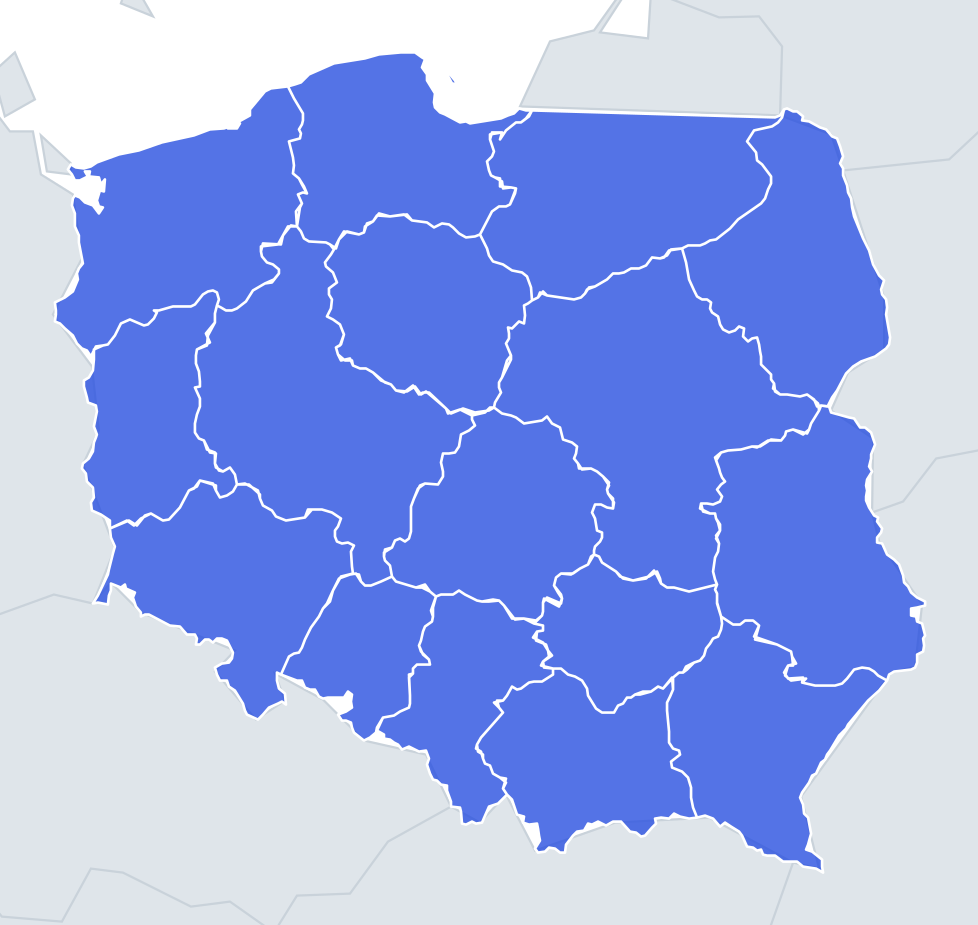
Only the shape is shown, with no map around it. Can you tell which voivodeship it is? A great way to really learn Polish Voivodeships.
Top scores
- The five fastest 100% rounds on this quiz.
Finish with 100% and post your time to get on the board – here or in full screen. All leaderboards
Your next quiz
 Dutch Provinces quiz12 provinces
 French Regions quiz13 regions
What's on this map
Sixteen voivodeships shown one at a time as shapes. Poland's outer border is mostly the result of 1945, when the country was moved west: the Oder and Neisse rivers became the German border, and the eastern border follows roughly the Curzon Line drawn after the First World War. Those two edges are the best clues. A long, wiggly river line on the left means a western voivodeship on the Oder–Neisse; the Bug river forms a long stretch of the eastern edge of Lublin and Podlachian.
The coast is the other giveaway. West Pomeranian has the Szczecin Lagoon cut into its north-west corner. Pomeranian includes the thin Hel Peninsula curling into the Bay of Gdańsk, and part of the Vistula Spit. Warmian-Masurian has a straight northern edge – the border with Russia's Kaliningrad region, drawn with a ruler in 1945 – and a lake-dotted interior.
Inland shapes need size and proportion. Masovian is the largest voivodeship, a broad, sprawling shape in the centre-east. Opole is the smallest and Świętokrzyskie the second smallest, both compact and roughly round.
The places people miss
- Lubusz – tall and narrow, with the Oder and Neisse forming its whole western side.
- Lower Silesian – wide, with a jagged south-western edge along the Sudetes and the Czech border; the corner around Bogatynia pokes out towards Germany and the Czech Republic.
- Silesian vs Lesser Poland – Silesian is a tall, narrow shape; Lesser Poland is wider with a ragged mountain border on the bottom, where the Tatras meet Slovakia.
- Subcarpathian – the south-east corner, with the Bieszczady mountains pointing down at the bottom right.
- Kuyavian-Pomeranian – a rounded shape with the Vistula running through it from south-east to north.
- Łódź – a compact, roughly square block right in the centre of the country, with no international border.
How to learn it
- Sort the shapes into border types: Baltic coast, German river border, mountain border, eastern river border, and fully inland.
- For the inland ones – Łódź, Greater Poland, Kuyavian-Pomeranian, Świętokrzyskie – use size: Greater Poland is big, Świętokrzyskie small, Łódź in between.
- Use Study the map once to see where each shape sits, then let the Mistake Bank collect the confusions.
- Done means 16 of 16 correct in one run.
Guides that help with this
- Oceans, seas, rivers and mountainsThe physical map: seas around each continent, the big rivers and ranges.
- Why you forget countries – and how spaced repetition fixes itThe forgetting curve, and how the Mistake Bank and flashcards use it.
- Flags that look alike (and how to tell them apart)Chad or Romania? Australia or New Zealand? The flag pairs that cost quiz points.
How it works
Each question shows one outline and four names. Similar-sized voivodeships are mixed in, so it gets tricky.
All 16 voivodeships in this quiz
Greater Poland, Kuyavian-Pomeranian, Lesser Poland, Łódź, Lower Silesian, Lublin, Lubusz, Masovian, Opole, Podlachian, Pomeranian, Silesian, Subcarpathian, Świętokrzyskie, Warmian-Masurian, West Pomeranian.