Central America Map: All 7 Countries and Capitals, Plus Where Mexico Fits
On this page
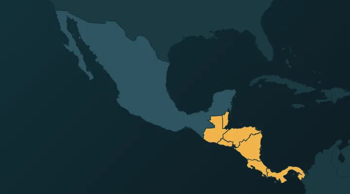
Central America is the narrow land bridge between Mexico and Colombia, and it holds seven countries. After reading this you will be able to place all seven in order, name every capital, and know why our Central America quiz also asks you for Mexico while the Caribbean islands get a quiz of their own.
The order: seven countries in a curve
The isthmus runs from north-west to south-east, then bends east at the end. Read it like a line of text:
Guatemala – Belize – El Salvador – Honduras – Nicaragua – Costa Rica – Panama.
Two of them break the line. Belize sits on the Caribbean side, tucked into the corner east of Guatemala. El Salvador sits on the Pacific side, below Honduras. Everything else spans from coast to coast.
A sentence that keeps the order: "Great Big Elephants Hate Narrow Country Paths." Guatemala, Belize, El Salvador, Honduras, Nicaragua, Costa Rica, Panama.
Two quick facts fix the extremes. Nicaragua is the largest country by area (about 130,000 km²) and holds Lake Nicaragua, the biggest lake in Central America. El Salvador is the smallest of the seven on the mainland and the only one with no Caribbean coast.
The north: Guatemala and Belize
Guatemala – Guatemala City. The north-west block, bordering Mexico along its north and west. It has the most people in Central America, about 18 million. The capital moved to its present site in 1776 after earthquakes in 1773 wrecked the old capital, now called Antigua Guatemala. Memory hook: the country and its capital share a name – just add "City".
Belize – Belmopan. The small country on the Caribbean coast, south of Mexico's Yucatán and east of Guatemala. Until 1973 it was called British Honduras, it became independent only in 1981, and English is its official language – the only Central American country where that is true. Its population is about 400,000.
Belmopan is the capital people miss, because the famous city is Belize City on the coast. Hurricane Hattie badly damaged Belize City in 1961, so the government built a new capital about 80 km inland and moved there in 1970. Memory hook: Belmopan = Belize River + Mopan River – a made-up name for a made-up town, built inland where two rivers meet, away from the storm coast.
The middle: El Salvador, Honduras, Nicaragua
El Salvador – San Salvador. The small strip on the Pacific side, south of Guatemala and Honduras. It is about 21,000 km² and has about 6 million people, which makes it by far the most crowded of the seven. Memory hook: El Salvador means "the Saviour", and San Salvador means "Holy Saviour" – the capital simply adds "San".
Honduras – Tegucigalpa. The wide country above Nicaragua, with a long Caribbean coast in the north and only a short Pacific shore on the Gulf of Fonseca in the south. About 11 million people. Tegucigalpa became the permanent capital in 1880, taking over from Comayagua. Officially the capital is Tegucigalpa and its twin city Comayagüela together, which are joined into one Central District. Memory hook: Tegucigalpa is the longest capital name in the region – Honduras is the widest country in the middle of the region. Pronounce it "teh-GOO-see-GAL-pa" and it gets easier to recall.
Nicaragua – Managua. The largest country, directly south of Honduras. Managua sits on the shore of Lake Managua. It became the capital in 1852 as a compromise: the two old rival cities, León and Granada, could not agree on which should lead, so the government chose the town between them. Memory hook: Nicaragua and Managua both end in "-agua" (water) – and the capital sits on a lake.
The south: Costa Rica and Panama
Costa Rica – San José. Between Nicaragua and Panama, with coasts on both oceans. San José lies in the Central Valley, the highland basin where most Costa Ricans live. The country abolished its army in 1948, and the 1949 constitution made that permanent. Do not confuse it with Puerto Rico, which is a US territory in the Caribbean, not part of Central America.
Panama – Panama City. The last country, where the isthmus turns and runs west to east into Colombia. Because of that turn, the Caribbean is to the north and the Pacific to the south. Panama City is on the Pacific side, at the southern end of the canal. Panama split from Colombia in 1903; the canal opened in 1914 and passed to Panama on 31 December 1999. Memory hook: like Guatemala, the capital is the country name plus "City" – the two "City" capitals are the first and last countries in the line.
The quick list
| Country | Capital | Where | Hook |
|---|---|---|---|
| Guatemala | Guatemala City | North-west, borders Mexico | Country name + City |
| Belize | Belmopan | Caribbean corner east of Guatemala | Inland capital built after a hurricane |
| El Salvador | San Salvador | Pacific side, smallest | "Saviour" → "Holy Saviour" |
| Honduras | Tegucigalpa | Wide, long Caribbean coast | Longest name, widest country |
| Nicaragua | Managua | Largest, has the big lake | Both end in "-agua" |
| Costa Rica | San José | Two coasts, between Nicaragua and Panama | No army since 1948 |
| Panama | Panama City | The east–west bend into Colombia | Country name + City, Pacific side |
Three traps that cost points
Belize City is not the capital. It is the largest city and the main port, which is why it feels like the answer. The capital is Belmopan.
Honduras vs Belize. "British Honduras" was Belize's old name, not Honduras's. Today they are separate countries, and they do not even share a land border – Guatemala sits between them, with only a sea boundary off the coast.
The two "San" capitals. San Salvador belongs to El Salvador; San José belongs to Costa Rica. Link each to the country that is closest in sound: Salvador → San Salvador. San José is the one left over. (San Juan is Puerto Rico and does not appear in the country quizzes.)
The flags are a trap of their own. Guatemala, El Salvador, Honduras and Nicaragua all use blue–white–blue stripes inherited from the old Federal Republic of Central America (1823–1841), and Costa Rica adds a red band in the middle. Guatemala's stripes are vertical; the others are horizontal. See Flags that look alike for the full breakdown.
Where Mexico fits
The usual school answer is "seven countries", and that is the list above. But there is a second, official definition. The United Nations' statistical regions (the M49 standard) put Mexico in "Central America", alongside the seven. Geographers also often use "Middle America" for Mexico plus the seven countries, sometimes with the Caribbean too.
Our Central America quiz follows the UN grouping, so it has eight countries including Mexico. That is also practical: Mexico borders Guatemala and Belize, and you cannot click Guatemala confidently without seeing where Mexico ends. On the map, Mexico's narrow waist at the Isthmus of Tehuantepec is where some physical geographers say Central America begins.
Mexico – Mexico City. The giant to the north-west, with about 130 million people. Its capital follows the same pattern as Guatemala and Panama: country name plus "City".
Where the Caribbean fits
The island countries – Cuba, Jamaica, Haiti, the Dominican Republic, the Bahamas and the small states of the Lesser Antilles – are not part of Central America. They form their own region, with 13 independent countries, and have their own Caribbean quiz.
All three groups – Mexico, Central America and the Caribbean – are part of North America. That is why our North America quiz has 23 countries: Canada, the United States, Mexico, the seven Central American countries and the 13 Caribbean countries.
Panama is the edge. It borders Colombia, which is in South America, across the Darién Gap, a roadless stretch of jungle that also breaks the Pan-American Highway. The continent line is usually drawn at the Panama–Colombia border, which puts all of Panama in North America. For the next step south, see South America: all 12 countries and capitals.
Practise it
- Central America – place all eight on the map.
- Central America capitals – Belmopan and Tegucigalpa are the two to watch.
- Central America flags – the blue–white–blue set.
- The Caribbean – when the mainland is clean.
Tip: play the map quiz once, say the line "Guatemala, Belize, El Salvador, Honduras, Nicaragua, Costa Rica, Panama" out loud, then play the capitals quiz the next day without looking at this page. Whatever you miss, write down and replay the day after.
FAQ
What are the 7 countries of Central America?
Guatemala, Belize, El Salvador, Honduras, Nicaragua, Costa Rica and Panama. Their capitals are Guatemala City, Belmopan, San Salvador, Tegucigalpa, Managua, San José and Panama City.
Is Mexico part of Central America?
Usually not – Mexico is normally counted simply as part of North America. The UN statistical grouping does list it under Central America, though, which is why our Central America quiz includes it.
What is the largest country in Central America?
By area, Nicaragua, at about 130,000 km². By population, Guatemala, with about 18 million people.
Which Central American country speaks English?
Belize. English is its official language, a legacy of its time as British Honduras, though Spanish and Kriol are widely spoken too.
Sources
More guides
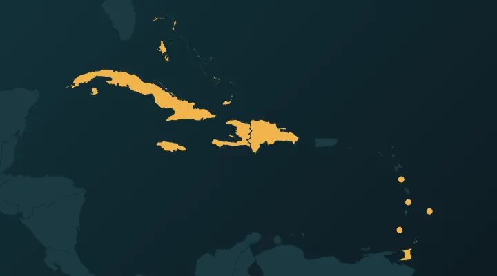 Caribbean Countries and Capitals – All 13, With Map Hooks
All 13 Caribbean countries and capitals in map order, with hooks for the traps: Dominica, Kingston vs Kingstown, the three saints.
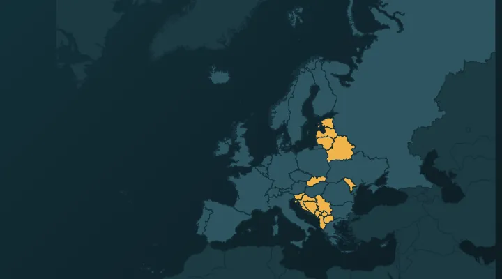 How to Learn All European Countries on the Map
A one-week method to learn all 46 European countries on the map: regions in order, key borders, and how to crack the Balkans and the microstates.
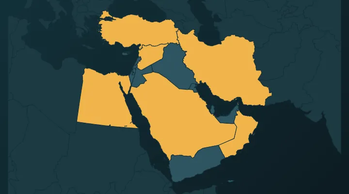 Middle East Map: How to Learn All 17 Countries and Their Capitals
The 17 countries of the Middle East and their capitals, peninsula first – and the four capitals everyone gets wrong.