The 20 Largest Countries in the World by Area – and Where They Are
On this page
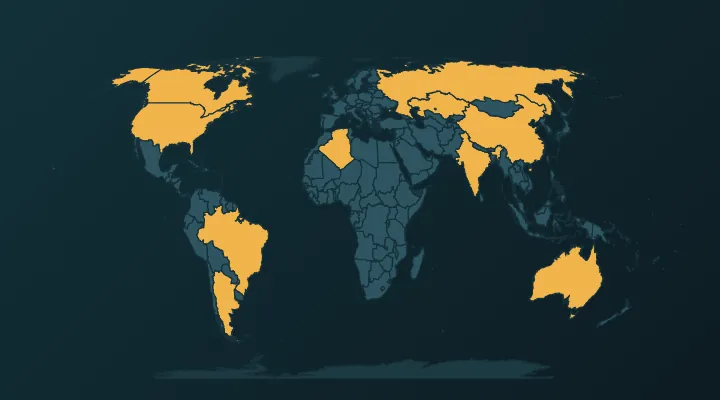
Six countries – Russia, Canada, China, the United States, Brazil and Australia – cover about 40 % of all the land on Earth. After them the sizes drop sharply, and the next fourteen are a mix of desert giants, rainforest states and one huge archipelago. This guide lists the 20 largest countries by area, shows where each one sits, explains why sources disagree about the order, and corrects the map illusion that makes Greenland look as big as Africa.
The top 20 at a glance
Areas are total areas (land plus lakes and rivers), rounded, from the UN Statistics Division as compiled in standard reference lists. Different sources move a few countries by a place or two; the reasons are explained below the table.
| Rank | Country | Area (km²) | Continent |
|---|---|---|---|
| 1 | Russia | 17.1 million | Europe / Asia |
| 2 | Canada | 9.98 million | North America |
| 3 | China | 9.6 million | Asia |
| 4 | United States | 9.5 million | North America |
| 5 | Brazil | 8.5 million | South America |
| 6 | Australia | 7.7 million | Oceania |
| 7 | India | 3.29 million | Asia |
| 8 | Argentina | 2.78 million | South America |
| 9 | Kazakhstan | 2.72 million | Asia |
| 10 | Algeria | 2.38 million | Africa |
| 11 | DR Congo | 2.34 million | Africa |
| 12 | Saudi Arabia | 2.15 million | Asia |
| 13 | Mexico | 1.96 million | North America |
| 14 | Indonesia | 1.9 million | Asia |
| 15 | Sudan | 1.88 million | Africa |
| 16 | Libya | 1.76 million | Africa |
| 17 | Iran | 1.65 million | Asia |
| 18 | Mongolia | 1.56 million | Asia |
| 19 | Peru | 1.29 million | South America |
| 20 | Chad | 1.28 million | Africa |
Just below the cut: Niger, Angola, Mali and South Africa. By continent the top 20 is seven in Asia, five in Africa, three in North America, three in South America, one in Oceania and Russia straddling Europe and Asia.
The giants: 1 to 6
1. Russia – 17.1 million km². Almost twice the size of Canada and about one-ninth of all the land on Earth. It runs about 9,000 km from the Baltic to the Pacific and spans 11 time zones. The bit most people forget is Kaliningrad, the detached piece on the Baltic between Poland and Lithuania. Memory hook: Russia is nearly two Canadas.
2. Canada – 9.98 million km². The largest country in the Americas and the second largest in the world, but much of that is water – Canada has more lakes than any other country, and about 9 % of its total area is fresh water. It also has the world's longest coastline, around 243,000 km, mostly around its Arctic islands. Measured by land alone, Canada drops behind China and the US.
3. China – 9.6 million km². The largest country entirely in Asia. It reaches from the Pamirs in the west to the Pacific coast and from Mongolia to the Himalayas, yet it uses a single time zone. China is joint record holder with Russia for the most neighbouring countries (14 each) – see countries with the most neighbours.
4. United States – about 9.5 million km². Third or fourth depending on how you measure (see below). Alaska alone is about 1.7 million km² – as a country it would rank 17th in the world, between Libya and Iran. Memory hook: Alaska is more than twice the size of Texas.
5. Brazil – 8.5 million km². Nearly half of South America. It borders every South American country except Chile and Ecuador. The Amazon basin covers most of the north, and the equator crosses its far north near the mouth of the Amazon.
6. Australia – 7.7 million km². The only country that is also a whole continent. Most of its 27 million people live in a thin coastal band in the east and south-east; the interior is desert and dry grassland. Memory hook: Australia is roughly the same size as the mainland United States without Alaska.
The big middle: 7 to 13
7. India – 3.29 million km². Less than half the size of Australia, but the most populous country in the world.
8. Argentina – 2.78 million km². The largest Spanish-speaking country by area. It stretches about 3,700 km from the tropics down to Tierra del Fuego. Its claims to the Falklands and part of Antarctica are not included.
9. Kazakhstan – 2.72 million km². The largest landlocked country in the world, and the largest country with a majority-Muslim population. A small part west of the Ural River lies in Europe. On the map it is the huge country directly south of Russia and west of China.
10. Algeria – 2.38 million km². The largest country in Africa since Sudan split in 2011. More than four-fifths of it is Sahara; nearly everybody lives along the Mediterranean coast in the north.
11. DR Congo – 2.34 million km². The largest country in sub-Saharan Africa, covering most of the Congo River basin. It has a coastline of only about 40 km on the Atlantic, at the mouth of the Congo. Don't confuse it with its western neighbour, the much smaller Republic of the Congo.
12. Saudi Arabia – 2.15 million km². Fills about four-fifths of the Arabian Peninsula and is often described as the largest country without a permanent river. Greenland (2.17 million km²) is very slightly bigger, which is why Greenland sometimes appears in "top 12" lists – but it is a self-governing territory, not an independent country.
13. Mexico – 1.96 million km². The third-largest country in North America and the most populous Spanish-speaking country.
The rest of the top 20: 14 to 20
14. Indonesia – 1.9 million km². The largest country made entirely of islands – more than 17,000 of them – stretching about 5,000 km from Sumatra to New Guinea. Memory hook: from end to end, Indonesia is wider than the contiguous United States.
15. Sudan – 1.88 million km². Africa's largest country until South Sudan became independent in 2011, which took away about a quarter of its territory and dropped it from 10th place in the world.
16. Libya – 1.76 million km². Almost entirely Sahara, and like Algeria and Saudi Arabia it has no permanent river.
17. Iran – 1.65 million km². The second-largest country in the Middle East after Saudi Arabia, between the Caspian Sea in the north and the Persian Gulf in the south.
18. Mongolia – 1.56 million km². Wedged between Russia and China, it is the second-largest landlocked country and the most sparsely populated sovereign state in the world, with only about 2 people per km².
19. Peru – 1.29 million km². Pacific coast desert, the Andes and a large slice of Amazon rainforest. Most people picture it smaller than it is.
20. Chad – 1.28 million km². In the middle of northern Africa, south of Libya. The lake it is named after, Lake Chad, has shrunk dramatically since the 1960s.
Why sources disagree: land vs total area
There are three common ways to measure a country:
- Land area – dry land only.
- Total area – land plus inland water (lakes, rivers, reservoirs).
- Total area including coastal and territorial waters – used by the CIA World Factbook (discontinued in 2026) for the United States, but not for China.
The third definition is the reason the US and China swap places. The United States, measured with its coastal and territorial waters, comes to about 9.83 million km² and moves above China. Measured the same way as China (land and inland water only), the US is about 9.53 million km² and China, at 9.6 million, is larger. On land area alone, China is ahead too. Most reference books today put China third and the US fourth; you will still see the opposite.
Canada is the other way round: its lakes push its total area up, but on land alone it is smaller than both China and the US.
The map that lies: Greenland and Africa
On the familiar Mercator world map, Greenland looks about the size of Africa. In reality Africa covers about 30.4 million km² and Greenland about 2.2 million km². Africa is around 14 times bigger.
Mercator's 1569 projection was made for sailors: it keeps directions correct, so areas stretch more and more towards the poles. The effects on this list:
- Russia and Canada look even bigger than they are. Both are far north, so both get inflated.
- Brazil, DR Congo and Indonesia look smaller than they are. All three sit on or near the equator, where the stretch is smallest. Brazil is larger than Australia and bigger than the contiguous United States, which few people guess from a Mercator map.
- Africa as a whole is undersold. The US, China, India and most of Europe would fit inside it together.
When you play a size quiz, mentally shrink anything near the poles and inflate anything near the equator. An equal-area projection (such as Equal Earth or Mollweide) shows the true proportions.
A simple way to remember the order
- The big six: Rus-Can-Chi-US-Bra-Aus – learn them as a chant. Each is more than 7.5 million km².
- The 2–3 million club: India, Argentina, Kazakhstan, Algeria, DR Congo, Saudi Arabia. One per region: South Asia, South America, Central Asia, North Africa, Central Africa, Arabia.
- The 1.2–2 million club: Mexico, Indonesia, Sudan, Libya, Iran, Mongolia, Peru, Chad. Four of them are mostly desert.
Notice that no country in Europe apart from Russia makes the top 20. The largest country entirely in Europe is Ukraine, at about 600,000 km², in roughly 45th place in the world.
Practise it
- Whole World – size – two countries, pick the bigger one; also lists all 197 by area.
- Africa – size and Asia – size – the continents with the most entries on this list.
- Whole World – find every top-20 country on the map.
- Tip: play the size quiz once, note every pair you got wrong, and check whether the country you over-rated was far from the equator. After a day or two the Mercator bias corrects itself.
FAQ
What is the largest country in the world?
Russia, at about 17.1 million km² – almost twice the size of the next largest, Canada.
Is China bigger than the United States?
On land area, and on total area measured the same way for both, yes. The US only comes out bigger when its coastal and territorial waters are counted, which is why some lists still show it third.
What is the largest country in Africa?
Algeria, about 2.38 million km². It took the title from Sudan when South Sudan became independent in 2011.
Is Greenland bigger than Australia?
No. Australia is about 3.5 times bigger. Greenland only looks huge because of the Mercator projection, and it is a self-governing territory rather than an independent country.
Sources
More guides
 How Many Countries Are There in the World? (195, 197 or More?)
193, 195 or 197? What each count includes – Vatican, Palestine, Kosovo, Taiwan – why we use 197, and the places left out.
 All 45 Landlocked Countries – Where They Are and How to Remember Them
All 45 countries with no coastline, continent by continent – plus the two that are doubly landlocked.
 The 15 Smallest Countries in the World – and Where to Find Them on the Map
The 15 smallest countries in the world by area – how big they really are and where to find them on the map.