Lesotho vs Eswatini
Two countries people mix up, side by side. Facts first, then how to keep them apart on the map.
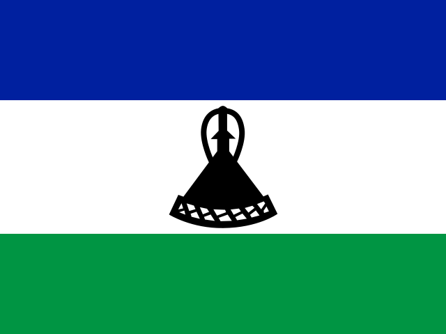
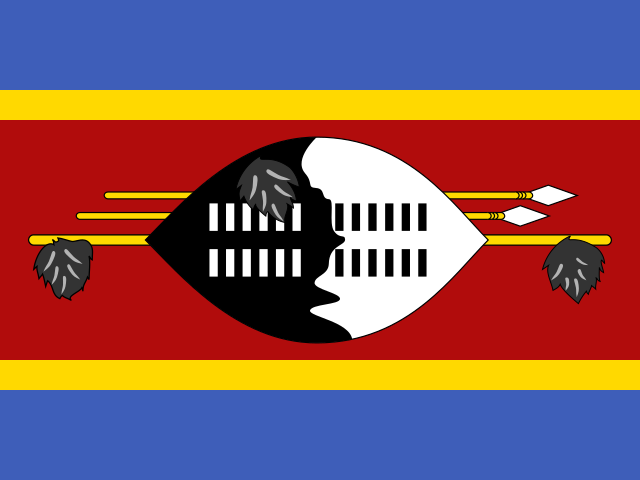
| Lesotho | Eswatini | |
|---|---|---|
| Capital | Maseru | Mbabane |
| Continent | Africa | Africa |
| Population | 2.1 million | 1.1 million |
| Area | 30,355 km² | 17,364 km² |
| Neighbours | South Africa | Mozambique and South Africa |
| Languages | English, Sotho | English, Swazi |
| Currency | Lesotho loti (LSL), South African rand (ZAR) | Swazi lilangeni (SZL) |
Lesotho is about 1.7 times the size of Eswatini, and Lesotho has about 1.9 times the population of Eswatini.
Why people mix them up
Both are tiny kingdoms almost swallowed by South Africa, both kept their monarchies through independence from Britain in the 1960s, and both have currencies pegged to the South African rand. Eswatini changed its name from Swaziland in 2018, which added another layer of confusion for anyone who learned the old map. Because they are the two small countries "inside" South Africa, people often remember that one exists but tap the wrong one.
How to tell them apart
- Lesotho is completely enclosed by South Africa; Eswatini also borders Mozambique on its eastern side.
- Lesotho is in the south, in the Drakensberg mountains; Eswatini is further north-east, near the Mozambique border and not far from Johannesburg.
- Lesotho is the only country in the world entirely above 1,000 m; Eswatini drops from highlands in the west to lowveld in the east.
- Lesotho is nearly twice the size, about 30,000 km² against Eswatini's 17,000 km², with roughly 2.3 million people against 1.2 million.
- Lesotho's flag is blue-white-green with a black Basotho hat in the centre; Eswatini's is blue-yellow-red with a black-and-white shield, two spears and a staff.
- Lesotho's capital is Maseru and its language is Sesotho; Eswatini's capitals are Mbabane and Lobamba, and its language is Swazi (siSwati).
Memory hook
Lesotho is the "lonely" one, locked in on all sides; Eswatini sits on the East edge of South Africa and gets a peek at Mozambique.
On the map
For Lesotho, find South Africa and tap the round hole in the middle-right part of it, roughly inland from Durban; it is completely surrounded. For Eswatini, go up the eastern border of South Africa towards Mozambique and tap the small country tucked into the notch between the two, just south of Kruger National Park. Lesotho is the one with no second neighbour.
Practise
More like this
- 15 pairs of countries people constantly mix upSlovakia vs Slovenia, Niger vs Nigeria – and how to keep each pair apart.
- Flags that look alike (and how to tell them apart)Chad or Romania? Australia or New Zealand? The flag pairs that cost quiz points.
- The 25 hardest countries to find on a mapPacific islands, Caribbean islands and landlocked Africa – where they are.