Malaysia vs Indonesia
Two countries people mix up, side by side. Facts first, then how to keep them apart on the map.
| Malaysia | Indonesia | |
|---|---|---|
| Capital | Kuala Lumpur | Jakarta |
| Continent | Asia | Asia |
| Population | 31.9 million | 270.6 million |
| Area | 330,803 km² | 1,904,569 km² |
| Neighbours | Brunei, Indonesia and Thailand | Malaysia, Papua New Guinea and Timor-Leste |
| Languages | Malay | Indonesian |
| Currency | Malaysian ringgit (MYR) | Indonesian rupiah (IDR) |
Indonesia is about 5.8 times the size of Malaysia, and Indonesia has about 8.5 times the population of Malaysia.
Why people mix them up
Malaysia and Indonesia are neighbours in maritime Southeast Asia that share the island of Borneo, and their national languages, Malay and Indonesian, are so close that speakers understand each other easily. Both are Muslim-majority countries with similar food and traditions, and both flags are red and white. People often ask which country owns which part of Borneo, and which of the two is bigger.
How to tell them apart
- Indonesia is far larger, spread over thousands of islands and covering about 1.9 million km², several times the size of Malaysia.
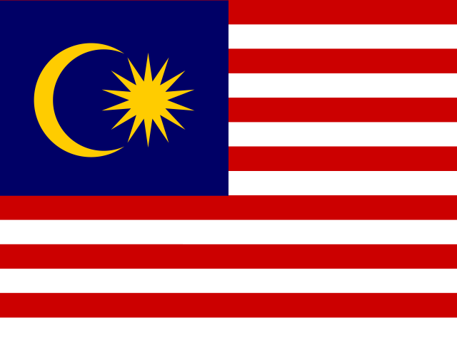
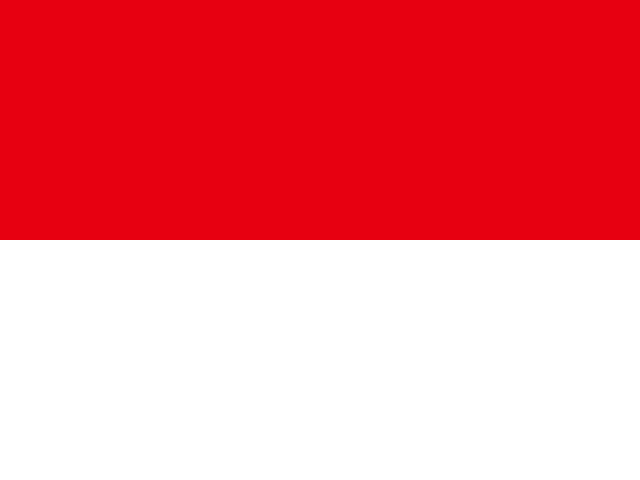
- Indonesia's flag is two plain horizontal bands, red over white; Malaysia's has red and white stripes with a blue corner holding a yellow crescent and star.
- Malaysia is in two parts: Peninsular Malaysia on the mainland and East Malaysia on northern Borneo.
- Indonesia holds the southern two-thirds or so of Borneo, called Kalimantan, along with Sumatra, Java, Sulawesi and western New Guinea.
- Malaysia's capital is Kuala Lumpur; Indonesia's government has long been based in Jakarta, on the island of Java.
- The currencies are the ringgit (Malaysia) and the rupiah (Indonesia).
Memory hook
Indonesia's flag is the simple one, just red over white; Malaysia's has stripes like the US flag plus a moon and star. Indonesia is the Immense archipelago, Malaysia the Mainland-plus-Borneo pair.
On the map
Find the long peninsula reaching south from Thailand towards Singapore. Its southern part is Peninsular Malaysia. Across the South China Sea, the northern strip of the big island of Borneo is East Malaysia, with tiny Brunei tucked inside it. Everything else on Borneo, plus Sumatra to the west of the peninsula and the long chain of islands stretching east to New Guinea, is Indonesia. If you are tapping Sumatra or Java, it is Indonesia.
Practise
More like this
- 15 pairs of countries people constantly mix upSlovakia vs Slovenia, Niger vs Nigeria – and how to keep each pair apart.
- Flags that look alike (and how to tell them apart)Chad or Romania? Australia or New Zealand? The flag pairs that cost quiz points.
- The 25 hardest countries to find on a mapPacific islands, Caribbean islands and landlocked Africa – where they are.