Togo vs Benin
Two countries people mix up, side by side. Facts first, then how to keep them apart on the map.
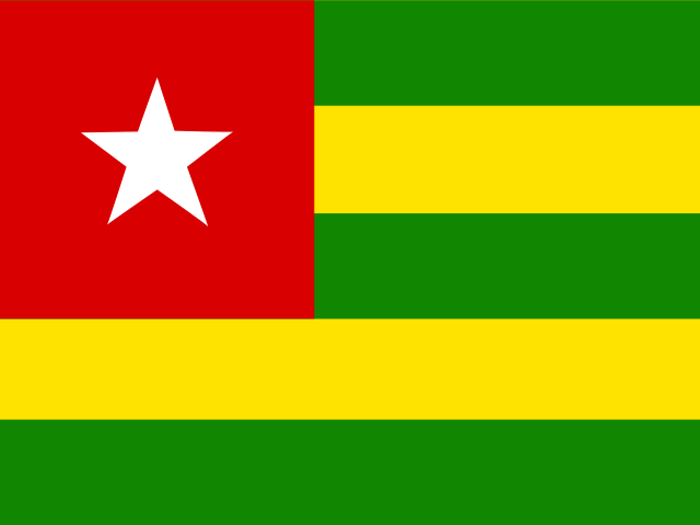
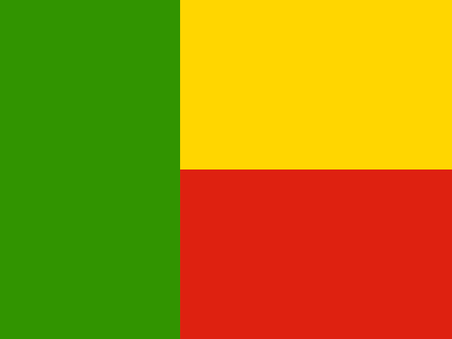
| Togo | Benin | |
|---|---|---|
| Capital | Lomé | Porto-Novo |
| Continent | Africa | Africa |
| Population | 8.1 million | 11.8 million |
| Area | 56,785 km² | 112,622 km² |
| Neighbours | Benin, Burkina Faso and Ghana | Burkina Faso, Niger, Nigeria and Togo |
| Languages | French | French |
| Currency | West African CFA franc (XOF) | West African CFA franc (XOF) |
Benin is about 2 times the size of Togo, and Benin has about 1.5 times the population of Togo.
Why people mix them up
Togo and Benin are next-door neighbours on the Gulf of Guinea and have almost the same shape: narrow strips of land running north from a short coastline, each roughly 550 to 650 km long and only 50 to 100 km wide at the coast. Both are French-speaking former colonies, both use the West African CFA franc, and both have capitals right on the coast within a couple of hours' drive of each other. In a shape quiz they are among the hardest pairs to separate.
How to tell them apart
- Togo is the western one, between Ghana and Benin; Benin is to the east, between Togo and Nigeria.
- Benin is about twice the size, roughly 115,000 km² against Togo's 57,000 km², and wider in the north.
- Togo's flag has five green and yellow horizontal stripes with a red square and white star in the corner; Benin's has a green vertical band at the hoist and yellow over red on the fly.
- Benin has about 13 million people; Togo has around 9 million.
- Togo's capital is Lomé, right on the Ghanaian border; Benin's official capital is Porto-Novo, though the government largely sits in Cotonou.
- Benin was called Dahomey until 1975; Togo has kept its name since independence in 1960.
Memory hook
The two run alphabetically from the Nigerian side: Benin borders big Nigeria, Togo is tucked beside Ghana. "Togo touches Ghana, Benin bumps Nigeria."
On the map
Find Nigeria on the Gulf of Guinea. The first thin strip west of it is Benin; the next thin strip after that, before you reach the wider country of Ghana, is Togo. Both are tall and skinny, so aim for the middle of each strip rather than the coast. If the country you are tapping touches Nigeria, it is Benin; if it touches Ghana, it is Togo.
Practise
More like this
- 15 pairs of countries people constantly mix upSlovakia vs Slovenia, Niger vs Nigeria – and how to keep each pair apart.
- Flags that look alike (and how to tell them apart)Chad or Romania? Australia or New Zealand? The flag pairs that cost quiz points.
- The 25 hardest countries to find on a mapPacific islands, Caribbean islands and landlocked Africa – where they are.