Belgium vs Netherlands
Two countries people mix up, side by side. Facts first, then how to keep them apart on the map.
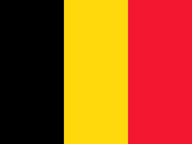
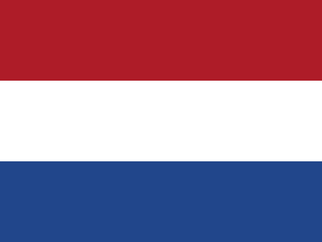
| Belgium | Netherlands | |
|---|---|---|
| Capital | Brussels | Amsterdam |
| Continent | Europe | Europe |
| Population | 11.5 million | 17.3 million |
| Area | 30,528 km² | 41,850 km² |
| Neighbours | France, Germany, Luxembourg and Netherlands | Belgium and Germany |
| Languages | Dutch, French, German | Dutch |
| Currency | Euro (EUR) | Euro (EUR) |
Netherlands is about 1.4 times the size of Belgium, and Netherlands has about 1.5 times the population of Belgium.
Why people mix them up
Belgium and the Netherlands are the two larger "Low Countries", flat and densely populated, sitting next to each other on the North Sea. Dutch is spoken in both: in the Netherlands, and in Flanders, the northern half of Belgium. They were briefly united in the early nineteenth century, and together with Luxembourg they form the Benelux. Add similar-sized territories and the frequent use of "Holland" for the Netherlands, and it is easy to lose track of which is which.
How to tell them apart
- Belgium's flag has vertical stripes of black, yellow and red; the Netherlands' flag has horizontal stripes of red, white and blue.
- Belgium has three official languages, Dutch, French and German; the Netherlands has Dutch, with Frisian recognised in Friesland.
- The capitals are Brussels (Belgium) and Amsterdam (Netherlands). In the Netherlands the government sits in The Hague.
- Belgium borders France and Luxembourg; the Netherlands borders only Belgium and Germany.
- The Netherlands is the larger of the two and has a much longer, more indented coastline with islands and estuaries.
- Belgium's coast is short and straight, only about 65 km of sandy beach.
Memory hook
The Netherlands is the "Nether" land on top, closer to the North Sea; Belgium sits Below it, with its flag standing up in vertical stripes.
On the map
Find the corner where France meets the North Sea. The country directly northeast of France, with a short straight coast, is Belgium. Keep going north along the coast and the land with the many inlets and islands, wedged between Belgium and Germany, is the Netherlands. If what you are tapping touches France, it is Belgium.
Practise
More like this
- 15 pairs of countries people constantly mix upSlovakia vs Slovenia, Niger vs Nigeria – and how to keep each pair apart.
- Flags that look alike (and how to tell them apart)Chad or Romania? Australia or New Zealand? The flag pairs that cost quiz points.
- The 25 hardest countries to find on a mapPacific islands, Caribbean islands and landlocked Africa – where they are.