Ethiopia vs Eritrea
Two countries people mix up, side by side. Facts first, then how to keep them apart on the map.
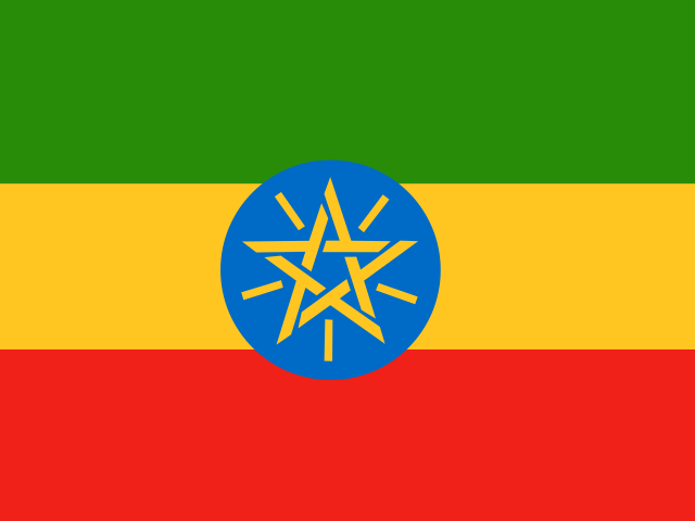
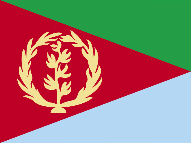
| Ethiopia | Eritrea | |
|---|---|---|
| Capital | Addis Ababa | Asmara |
| Continent | Africa | Africa |
| Population | 112.1 million | 6.1 million |
| Area | 1,104,300 km² | 117,600 km² |
| Neighbours | Djibouti, Eritrea, Kenya, Somalia, South Sudan and Sudan | Djibouti, Ethiopia and Sudan |
| Languages | Amharic | Tigrinya, Arabic, English |
| Currency | Ethiopian birr (ETB) | Eritrean nakfa (ERN) |
Ethiopia is about 9.4 times the size of Eritrea, and Ethiopia has about 18.4 times the population of Eritrea.
Why people mix them up
Eritrea was part of Ethiopia for several decades until it became independent in 1993, so older maps show the two as one country. They are neighbours in the Horn of Africa, share much history and culture, and both use the Ge'ez script for their main languages. Their flags both combine green, red and a blue element, and people often ask why Ethiopia, a large country, has no coastline.
How to tell them apart
- Eritrea has a long Red Sea coastline; Ethiopia has been landlocked since Eritrea's independence.
- Ethiopia is far larger, roughly nine times the area of Eritrea.
- Ethiopia's flag has horizontal green, yellow and red stripes with a blue disc and a yellow star; Eritrea's has a red triangle pointing from the hoist, separating green and blue triangles, with a gold olive wreath.
- The capitals are Addis Ababa (Ethiopia) and Asmara (Eritrea). Asmara is known for its Italian-era modernist architecture.
- Ethiopia's federal working language is Amharic; Eritrea has no official language, with Tigrinya, Arabic and English among those most widely used.
- The currencies are the birr (Ethiopia) and the nakfa (Eritrea).
Memory hook
Eritrea is the Edge on the Red sea; Ethiopia is the Enormous highland country behind it. Ethiopia's flag has the star in a blue circle; Eritrea's has the olive wreath.
On the map
Find the Red Sea and follow its western shore south. Just before the strait at its southern end, the long, thin coastal country stretching along the shore is Eritrea. Directly inland, to its south and west, lies Ethiopia, a large, roughly round country on a high plateau, bordered by Sudan, South Sudan, Kenya, Somalia and Djibouti. If the country you are tapping touches Kenya, it is Ethiopia.
Practise
More like this
- 15 pairs of countries people constantly mix upSlovakia vs Slovenia, Niger vs Nigeria – and how to keep each pair apart.
- Flags that look alike (and how to tell them apart)Chad or Romania? Australia or New Zealand? The flag pairs that cost quiz points.
- The 25 hardest countries to find on a mapPacific islands, Caribbean islands and landlocked Africa – where they are.