Georgia vs Armenia
Two countries people mix up, side by side. Facts first, then how to keep them apart on the map.
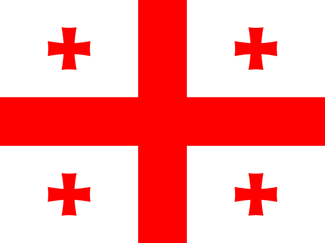
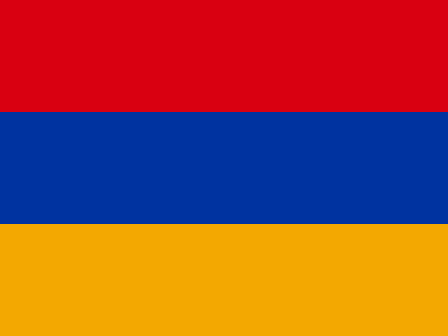
| Georgia | Armenia | |
|---|---|---|
| Capital | Tbilisi | Yerevan |
| Continent | Asia | Asia |
| Population | 3.7 million | 3 million |
| Area | 69,700 km² | 29,743 km² |
| Neighbours | Armenia, Azerbaijan, Russia and Turkey | Azerbaijan, Georgia, Iran and Turkey |
| Languages | Georgian | Armenian, Russian |
| Currency | Georgian lari (GEL) | Armenian dram (AMD) |
Georgia is about 2.3 times the size of Armenia, and Georgia has about 1.3 times the population of Armenia.
Why people mix them up
Georgia and Armenia are neighbours in the South Caucasus, both small, mountainous former Soviet republics with ancient Christian traditions. Each has its own unique alphabet, both are famous for winemaking and old stone churches, and they are often visited on the same trip. People also confuse the country of Georgia with the US state of the same name, and many are unsure which of the two countries lies on the Black Sea.
How to tell them apart
- Georgia has a coastline on the Black Sea; Armenia is landlocked.
- Georgia's flag is white with a large red cross and four small red crosses; Armenia's has horizontal red, blue and orange stripes.
- The capitals are Tbilisi (Georgia) and Yerevan (Armenia). Tbilisi lies on the Kura river.
- Georgian script has rounded, curly letters; Armenian script has its own distinct alphabet, with more upright, angular letters.
- Georgia is larger, about 70,000 km², more than twice the area of Armenia.
- Georgia borders Russia; Armenia borders Iran, which Georgia does not.
Memory hook
Georgia sits on top, along the Caucasus Mountains and the sea, and its flag carries crosses. Armenia sits below, with Mount Ararat, just over the border in Turkey, on the horizon, and its flag is a sunset of red, blue and orange.
On the map
Find the Black Sea and look at its eastern shore, south of Russia. The country along that shore, stretching inland along the Caucasus Mountains, is Georgia. Armenia is the smaller, landlocked country directly south of Georgia, between Turkey, Azerbaijan and Iran. If the country you are tapping touches the sea or Russia, it is Georgia.
Practise
More like this
- 15 pairs of countries people constantly mix upSlovakia vs Slovenia, Niger vs Nigeria – and how to keep each pair apart.
- Flags that look alike (and how to tell them apart)Chad or Romania? Australia or New Zealand? The flag pairs that cost quiz points.
- The 25 hardest countries to find on a mapPacific islands, Caribbean islands and landlocked Africa – where they are.