Colombia vs Venezuela
Two countries people mix up, side by side. Facts first, then how to keep them apart on the map.
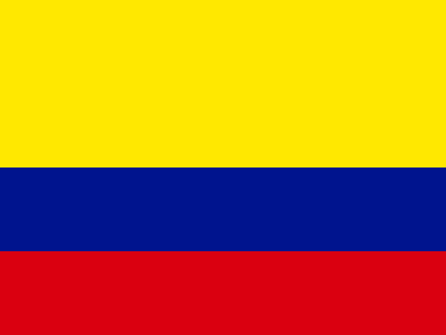
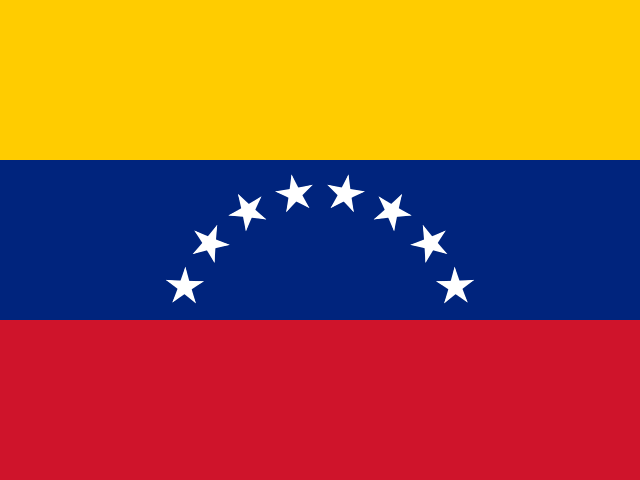
| Colombia | Venezuela | |
|---|---|---|
| Capital | Bogotá | Caracas |
| Continent | South America | South America |
| Population | 50.3 million | 28.5 million |
| Area | 1,141,748 km² | 916,445 km² |
| Neighbours | Brazil, Ecuador, Panama, Peru and Venezuela | Brazil, Colombia and Guyana |
| Languages | Spanish | Spanish |
| Currency | Colombian peso (COP) | Venezuelan bolívar (VES) |
Colombia is about 1.2 times the size of Venezuela, and Colombia has about 1.8 times the population of Venezuela.
Why people mix them up
Colombia and Venezuela share a long border and almost the same flag: yellow, blue and red horizontal stripes inherited from Gran Colombia, the republic that united them (with Ecuador) in the 1820s. Both are Spanish-speaking, both have Caribbean coastlines, both have the Andes in the west and the Orinoco and Amazon basins in the east. In a flag round the two are regularly confused with each other and with Ecuador, which uses the same colours too.
How to tell them apart
- Colombia's flag has a yellow stripe that takes up the top half; Venezuela's three stripes are equal and the blue carries an arc of eight white stars.
- Venezuela is east of Colombia and touches Guyana and Brazil; Colombia touches Panama, Ecuador and Peru.
- Colombia has two coasts, Caribbean and Pacific; Venezuela has only a Caribbean coast.
- Colombia is bigger and more populous: about 1.14 million km² and 52 million people, against roughly 916,000 km² and 28 million.
- The capitals are Bogotá (Colombia), high in the Andes, and Caracas (Venezuela), just inland from the Caribbean.
- Colombia uses the peso; Venezuela uses the bolívar.
Memory hook
Colombia connects to Central America through Panama, so it is on the left. Venezuela comes later in the alphabet and sits further right, towards Guyana. Stars on the flag mean Venezuela.
On the map
For Colombia, start from Panama at the narrow neck between the Americas and tap the first country of South America below it, the one with coast on both the Caribbean and the Pacific. For Venezuela, tap the country immediately east of Colombia along the Caribbean coast, with the Orinoco delta on its eastern side and Guyana beyond it. If the country touches the Pacific, it is Colombia.
Practise
More like this
- 15 pairs of countries people constantly mix upSlovakia vs Slovenia, Niger vs Nigeria – and how to keep each pair apart.
- Flags that look alike (and how to tell them apart)Chad or Romania? Australia or New Zealand? The flag pairs that cost quiz points.
- The 25 hardest countries to find on a mapPacific islands, Caribbean islands and landlocked Africa – where they are.