Czechia vs Slovakia
Two countries people mix up, side by side. Facts first, then how to keep them apart on the map.
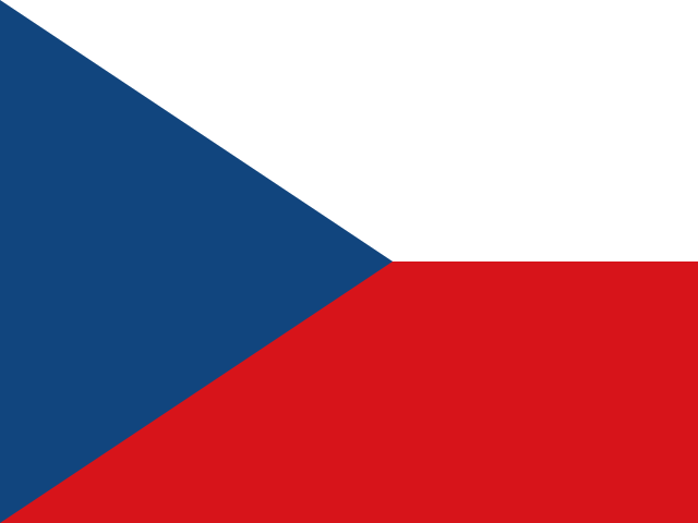
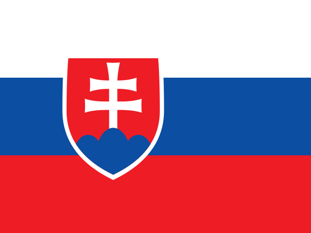
| Czechia | Slovakia | |
|---|---|---|
| Capital | Prague | Bratislava |
| Continent | Europe | Europe |
| Population | 10.7 million | 5.5 million |
| Area | 78,865 km² | 49,037 km² |
| Neighbours | Austria, Germany, Poland and Slovakia | Austria, Czechia, Hungary, Poland and Ukraine |
| Languages | Czech | Slovak |
| Currency | Czech koruna (CZK) | Euro (EUR) |
Czechia is about 1.6 times the size of Slovakia, and Czechia has about 2 times the population of Slovakia.
Why people mix them up
Czechia and Slovakia were one country, Czechoslovakia, until they separated peacefully on 1 January 1993. Many people still use the old name or are unsure which half is which. Their languages are so close that Czechs and Slovaks generally understand each other without difficulty, both countries are landlocked in Central Europe, and both flags use white, red and blue.
How to tell them apart
- Czechia is the western half; Slovakia is the eastern half, reaching Ukraine.
- Czechia's flag has a white stripe over a red stripe with a blue triangle at the hoist; Slovakia's is a white-blue-red horizontal tricolour with a coat of arms showing a white double cross.
- The capitals are Prague (Czechia) and Bratislava (Slovakia). Bratislava lies on the Danube right next to Austria and Hungary.
- Slovakia uses the euro; Czechia keeps its own currency, the Czech koruna.
- Czechia is the larger country, about 79,000 km² against Slovakia's roughly 49,000 km², and has more people.
- Czechia borders Germany; Slovakia borders Hungary and Ukraine, which Czechia does not.
Memory hook
Czechia kept the old Czechoslovak flag with its blue triangle; Slovakia, like Slovenia and Russia, went for horizontal white-blue-red. West is Czech, East is Slovak, in the same order as the old name.
On the map
Find Germany and Poland. The country tucked between them, wedged into Germany's eastern side, is Czechia. Continue east along Poland's southern border and the long, narrow country north of Hungary, ending at Ukraine, is Slovakia. If the country you are tapping touches Germany, it is Czechia.
Practise
More like this
- 15 pairs of countries people constantly mix upSlovakia vs Slovenia, Niger vs Nigeria – and how to keep each pair apart.
- Flags that look alike (and how to tell them apart)Chad or Romania? Australia or New Zealand? The flag pairs that cost quiz points.
- The 25 hardest countries to find on a mapPacific islands, Caribbean islands and landlocked Africa – where they are.