Israel vs Palestine
Two countries people mix up, side by side. Facts first, then how to keep them apart on the map.
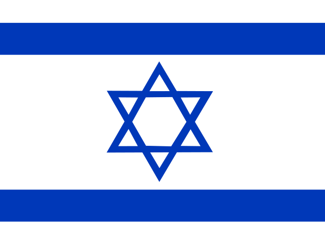
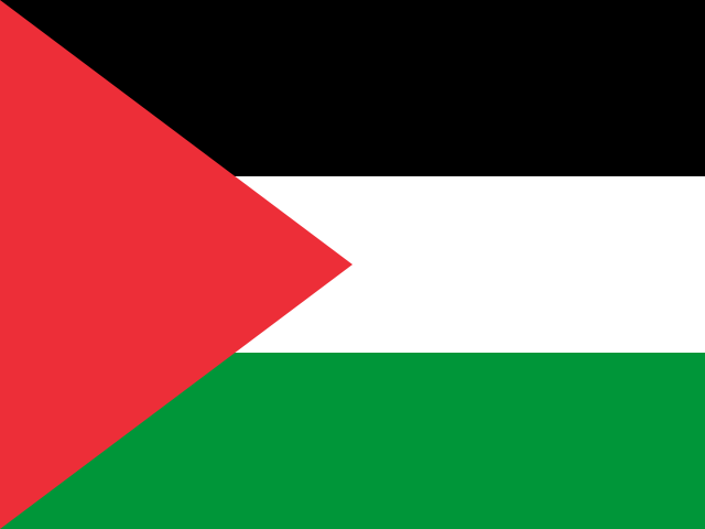
| Israel | Palestine | |
|---|---|---|
| Capital | Jerusalem | Ramallah |
| Continent | Asia | Asia |
| Population | 9.1 million | 4.7 million |
| Area | 20,770 km² | 6,220 km² |
| Neighbours | Egypt, Jordan, Lebanon, Palestine and Syria | Egypt, Israel and Jordan |
| Languages | Hebrew, Arabic | Arabic |
| Currency | Israeli new shekel (ILS) | Israeli new shekel (ILS) |
Israel is about 3.3 times the size of Palestine, and Israel has about 1.9 times the population of Palestine.
Why people mix them up
Israel and Palestine lie in the same small area between the Mediterranean Sea and the Jordan River, and maps show their borders in different ways. Palestine's recognition is disputed, and the status of Jerusalem is disputed too, so people often search where each one is, what their flags look like and which languages are spoken. This page sticks to geography, flags, capitals and languages.
How to tell them apart
- Israel's flag is white with two horizontal blue stripes and a blue Star of David; Palestine's has black, white and green horizontal stripes with a red triangle at the hoist.
- Palestine refers to two separate areas, the West Bank and the Gaza Strip; Israel lies between them.
- Hebrew is the main language of Israel, which also has a large Arabic-speaking population; Arabic is the main language of Palestine.
- Both claim Jerusalem as their capital, and its status is disputed. Israel's government sits in Jerusalem; Palestine's administrative offices are in Ramallah, in the West Bank.
- Israel reaches the Red Sea at Eilat on the Gulf of Aqaba; the Gaza Strip has a Mediterranean coast and the West Bank is landlocked.
- The West Bank borders Jordan along the Jordan River and Dead Sea; the Gaza Strip borders Egypt.
Memory hook
Israel's flag is blue and white with a star; Palestine's uses the four pan-Arab colours, black, white, green and red. The West Bank is named after the west bank of the Jordan River.
On the map
Find the eastern end of the Mediterranean, south of Lebanon. The area there, stretching south to a point on the Gulf of Aqaba, includes Israel. The West Bank is the inland area along the Jordan River and the Dead Sea, bordering Jordan. The Gaza Strip is a small coastal strip in the southwest, next to Egypt. If you are tapping the coast between Lebanon and Gaza, it is Israel.
Practise
More like this
- 15 pairs of countries people constantly mix upSlovakia vs Slovenia, Niger vs Nigeria – and how to keep each pair apart.
- Flags that look alike (and how to tell them apart)Chad or Romania? Australia or New Zealand? The flag pairs that cost quiz points.
- The 25 hardest countries to find on a mapPacific islands, Caribbean islands and landlocked Africa – where they are.