Zimbabwe vs Mozambique
Two countries people mix up, side by side. Facts first, then how to keep them apart on the map.
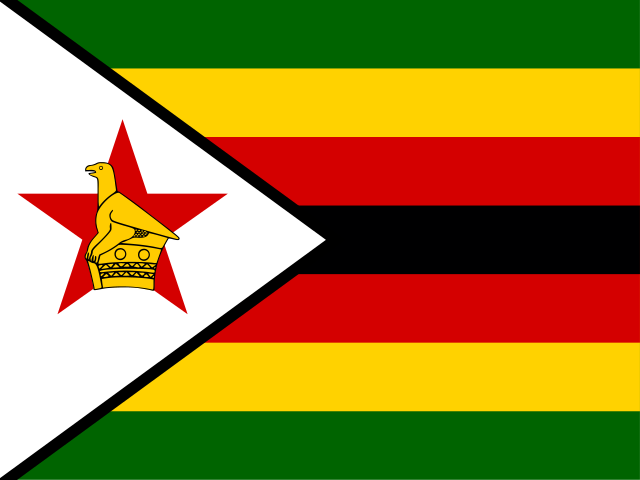
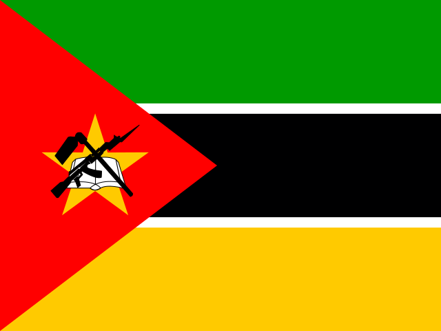
| Zimbabwe | Mozambique | |
|---|---|---|
| Capital | Harare | Maputo |
| Continent | Africa | Africa |
| Population | 14.6 million | 30.4 million |
| Area | 390,757 km² | 801,590 km² |
| Neighbours | Botswana, Mozambique, South Africa and Zambia | Eswatini, Malawi, South Africa, Tanzania, Zambia and Zimbabwe |
| Languages | English, Shona, Northern Ndebele | Portuguese |
| Currency | Zimbabwe gold (ZWG), US dollar (USD), South African rand (ZAR), Botswana pula (BWP), Pound sterling (GBP), Australian dollar (AUD), Chinese yuan (CNY), Indian rupee (INR), Japanese yen (JPY) | Mozambican metical (MZN) |
Mozambique is about 2.1 times the size of Zimbabwe, and Mozambique has about 2.1 times the population of Zimbabwe.
Why people mix them up
Zimbabwe and Mozambique are neighbours in southern Africa with a long shared border, and the Zambezi River flows through both on its way to the Indian Ocean. Both flags are crowded with colour and symbols, both include a star and a triangle at the hoist, and both countries gained independence from colonial rule in the second half of the twentieth century. People often compare them and wonder which one has the coast.
How to tell them apart
- Mozambique has a long Indian Ocean coastline; Zimbabwe is landlocked.
- Mozambique's official language is Portuguese; Zimbabwe has English among its sixteen official languages, with Shona and Ndebele widely spoken.
- Zimbabwe's flag has green, yellow, red and black stripes with a white triangle holding the Zimbabwe Bird; Mozambique's has green, black and yellow stripes with a red triangle bearing a book, a hoe and a rifle.
- The capitals are Harare (Zimbabwe) and Maputo (Mozambique). Maputo lies in the far south, near South Africa and Eswatini.
- Mozambique is the larger country, about 800,000 km², roughly twice the area of Zimbabwe.
- Victoria Falls is on Zimbabwe's border with Zambia; the Cahora Bassa dam on the Zambezi is in Mozambique.
Memory hook
Mozambique is a long coastal strip, like a Mosaic along the sea; Zimbabwe is the landlocked, roughly round country tucked inside its curve.
On the map
Find the southeast coast of Africa, opposite the island of Madagascar. The long country running down that coast, from Tanzania down to South Africa, is Mozambique. Zimbabwe lies directly inland to its west, between Zambia, Botswana and South Africa, partly wrapped by Mozambique on its eastern side. If the country you are tapping faces Madagascar, it is Mozambique.
Practise
More like this
- 15 pairs of countries people constantly mix upSlovakia vs Slovenia, Niger vs Nigeria – and how to keep each pair apart.
- Flags that look alike (and how to tell them apart)Chad or Romania? Australia or New Zealand? The flag pairs that cost quiz points.
- The 25 hardest countries to find on a mapPacific islands, Caribbean islands and landlocked Africa – where they are.