Zambia vs Zimbabwe
Two countries people mix up, side by side. Facts first, then how to keep them apart on the map.
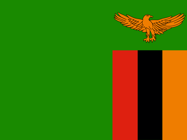
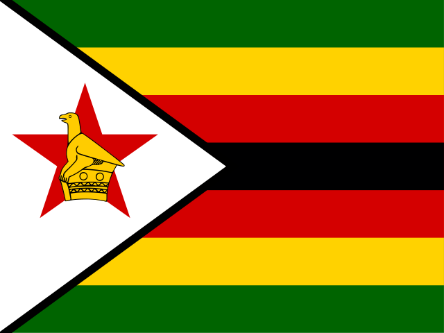
| Zambia | Zimbabwe | |
|---|---|---|
| Capital | Lusaka | Harare |
| Continent | Africa | Africa |
| Population | 17.9 million | 14.6 million |
| Area | 752,612 km² | 390,757 km² |
| Neighbours | Angola, DR Congo, Malawi, Mozambique, Namibia, Tanzania and Zimbabwe | Botswana, Mozambique, South Africa and Zambia |
| Languages | English | English, Shona, Northern Ndebele |
| Currency | Zambian kwacha (ZMW) | Zimbabwe gold (ZWG), US dollar (USD), South African rand (ZAR), Botswana pula (BWP), Pound sterling (GBP), Australian dollar (AUD), Chinese yuan (CNY), Indian rupee (INR), Japanese yen (JPY) |
Zambia is about 1.9 times the size of Zimbabwe, and Zambia has about 1.2 times the population of Zimbabwe.
Why people mix them up
Both begin with "Z", both are landlocked, English-speaking countries in southern Africa, and they share a long border formed by the Zambezi River, with Victoria Falls right on the line between them. Until the 1960s they were even administered together as Northern and Southern Rhodesia, and Zambia's name comes from the same river that gives Zimbabwe its most famous landmark. With that much shared history and geography, the two names blur easily.
How to tell them apart
- Zambia is north of the Zambezi River; Zimbabwe is south of it.
- Zambia is nearly twice the size, about 752,000 km² against 391,000 km², and has eight neighbours; Zimbabwe has four.
- Zambia touches DR Congo, Tanzania, Angola and Malawi; Zimbabwe touches South Africa, which Zambia never does.
- Zambia's flag is mostly green with an orange eagle and three vertical stripes in the lower corner; Zimbabwe's has seven horizontal stripes and a white triangle with the Zimbabwe Bird and a red star.
- The capitals are Lusaka (Zambia) and Harare (Zimbabwe).
- Zambia's shape looks like a butterfly or a bow tie; Zimbabwe is a compact, roughly rounded block.
Memory hook
Zambia is on the Zambezi's north bank and comes first alphabetically, so it is "on top". Zimbabwe is below, next to South Africa.
On the map
For Zimbabwe, start from South Africa and tap the country directly north of it, across the Limpopo River, with Botswana to the west and Mozambique to the east. For Zambia, keep going north over the Zambezi: the butterfly-shaped country with DR Congo pressing into its top edge is Zambia. If the outline you are tapping touches Tanzania or Angola, it is Zambia; if it touches South Africa, it is Zimbabwe.
Practise
More like this
- 15 pairs of countries people constantly mix upSlovakia vs Slovenia, Niger vs Nigeria – and how to keep each pair apart.
- Flags that look alike (and how to tell them apart)Chad or Romania? Australia or New Zealand? The flag pairs that cost quiz points.
- The 25 hardest countries to find on a mapPacific islands, Caribbean islands and landlocked Africa – where they are.