Europe in 1939 quiz
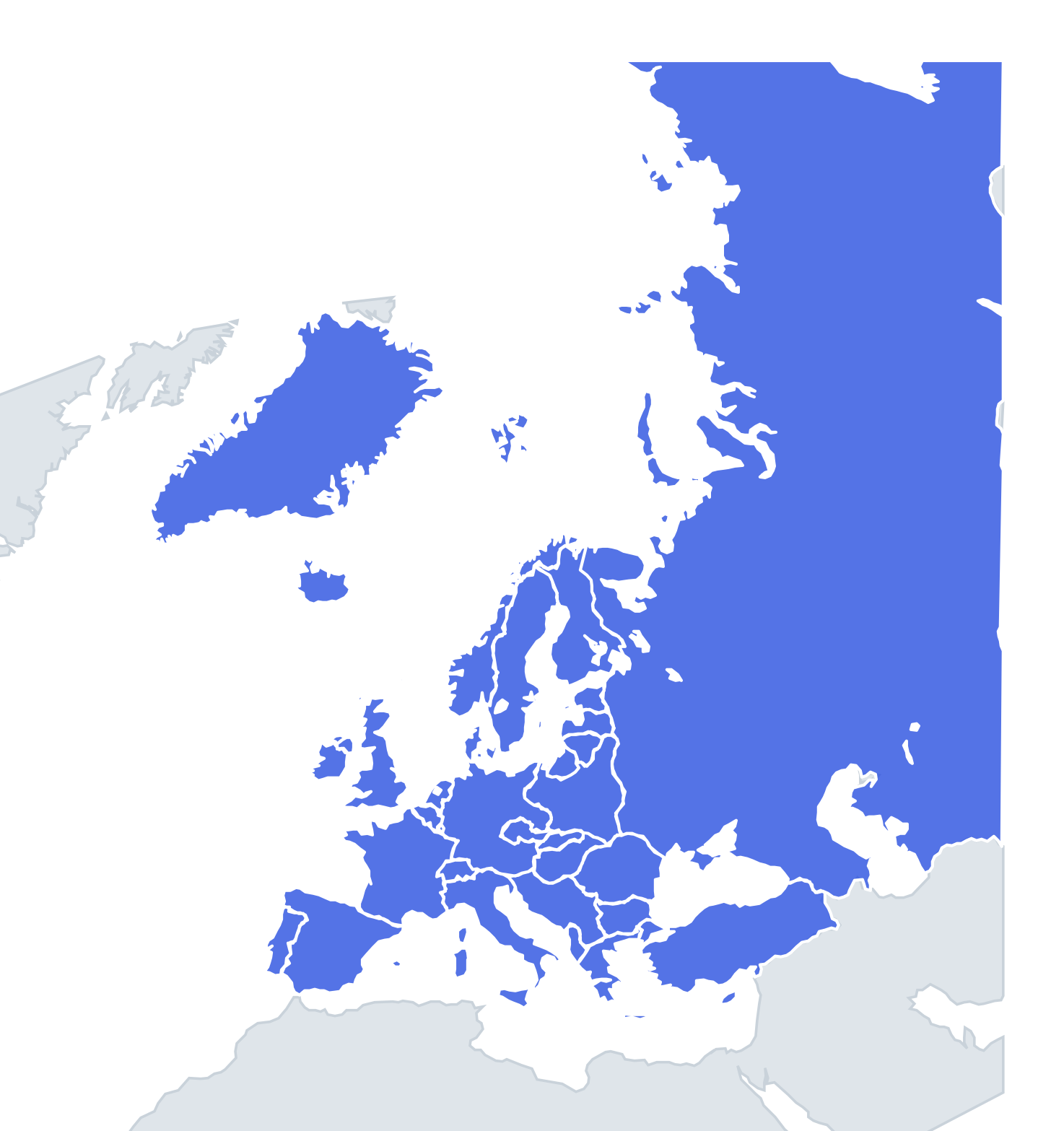
Europe on 1 September 1939, the day the Second World War began: Greater Germany, Slovakia, the Free City of Danzig and an independent Poland and Baltic states. Can you find them all?
Top scores
- Loading the leaderboard…
Play in full screen, finish with 100% and post your time to get on the board. All leaderboards
Your next quiz
 Europe in 1815 quiz51 states
 Roman Empire (AD 117) quiz46 provinces
What's on this map
Europe on 1 September 1939, the morning German troops crossed into Poland. In eighteen months Germany had grown fast. It annexed Austria in March 1938 and the Sudetenland in October 1938. In March 1939 it occupied the rest of the Czech lands as the Protectorate of Bohemia and Moravia, and took the Memel territory from Lithuania. Slovakia became a separate state under German protection, and Hungary took Carpatho-Ukraine. On this map Germany, Austria and the Czech lands are all part of the German Reich, with the Protectorate as its own shape.
The Second Polish Republic stretches far to the east, past Vilnius and Lviv. The Free City of Danzig sits on the Baltic between Poland and East Prussia. Estonia, Latvia and Lithuania are independent, Finland borders the Soviet Union near Leningrad, and Romania still has Bessarabia and northern Bukovina. Italy had occupied Albania in April 1939, and Ireland was independent and neutral.
The places people miss
- Free City of Danzig – a tiny city-state under the League of Nations, annexed by Germany on the first day of the war.
- Slovakia – separate from the Czech lands since March 1939, with its capital at Bratislava.
- Protectorate of Bohemia and Moravia – the Czech core around Prague, ruled from Berlin.
- Lithuania – Kaunas was the capital, because Poland held Vilnius.
- Albania – an Italian protectorate since April 1939.
- Iceland – an independent kingdom, but it still shared its king with Denmark.
How to learn it
- Start with the new Germany: trace Austria, the Sudetenland and East Prussia, then the Protectorate.
- Then go from north to south along the Soviet border: Finland, Estonia, Latvia, Lithuania, Poland, Romania.
- Use Study mode to read each country's status. Most of Europe declared itself neutral in September 1939.
- Compare with Europe in 1914 and Cold War Europe to see how much changed in 70 years.
Guides that help with this
- Oceans, seas, rivers and mountainsThe physical map: seas around each continent, the big rivers and ranges.
- Why you forget countries – and how spaced repetition fixes itThe forgetting curve, and how the Mistake Bank and flashcards use it.
- Flags that look alike (and how to tell them apart)Chad or Romania? Australia or New Zealand? The flag pairs that cost quiz points.
How to play
A name appears at the top. Tap that place on the map. You get three tries: green means first try, yellow second and orange third. After three misses the right place flashes. Tiny places get a circle so they are easy to hit, and you can zoom with two fingers or the mouse wheel.
Want a harder test? Try Name them all (type every country you can remember before the clock runs out) or Sudden death (one mistake and the game is over).
All 36 countries
| Country | Capital | Status in 1939 |
|---|---|---|
| Albania | Tirana | Occupied by Italy, April 1939 |
| Andorra | Andorra la Vella | Co-principality, neutral |
| Belgium | Brussels | Kingdom, neutral |
| Bulgaria | Sofia | Kingdom, neutral |
| Denmark | Copenhagen | Kingdom, neutral (Iceland in personal union) |
| Estonia | Tallinn | Republic, neutral (annexed by the USSR 1940) |
| Finland | Helsinki | Republic, neutral (attacked by the USSR in November 1939) |
| France | Paris | Republic, Allies (declared war 3 September 1939) |
| Free City of Danzig | Danzig | Free city under the League of Nations, annexed by Germany 1 September 1939 |
| German Reich | Berlin | Nazi dictatorship, Axis (Austria and the Sudetenland included) |
| Greece | Athens | Kingdom under Metaxas, neutral |
| Hungary | Budapest | Kingdom, close to the Axis |
| Iceland | Reykjavík | Kingdom in personal union with Denmark |
| Ireland | Dublin | Neutral |
| Italy | Rome | Fascist kingdom, Axis (entered the war June 1940) |
| Latvia | Riga | Republic, neutral (annexed by the USSR 1940) |
| Liechtenstein | Vaduz | Principality, neutral |
| Lithuania | Kaunas | Republic, neutral; Vilnius was Polish, Memel German |
| Luxembourg | Luxembourg | Grand duchy, neutral (invaded May 1940) |
| Monaco | Monaco | Principality |
| Netherlands | Amsterdam | Kingdom, neutral (invaded May 1940) |
| Norway | Oslo | Kingdom, neutral (invaded April 1940) |
| Poland | Warsaw | Republic, invaded by Germany 1 September 1939 |
| Portugal | Lisbon | Dictatorship, neutral |
| Protectorate of Bohemia and Moravia | Prague | German protectorate since March 1939 |
| Romania | Bucharest | Kingdom, neutral |
| San Marino | San Marino | Republic |
| Slovakia | Bratislava | German client state since March 1939 |
| Soviet Union | Moscow | Pact with Germany (August 1939), invaded Poland 17 September |
| Spain | Madrid | Dictatorship under Franco, neutral |
| Sweden | Stockholm | Kingdom, neutral |
| Switzerland | Bern | Confederation, neutral |
| Turkey | Ankara | Republic, neutral |
| United Kingdom | London | Kingdom, Allies (declared war 3 September 1939) |
| Vatican City | Vatican City | City-state of the Pope, neutral |
| Yugoslavia | Belgrade | Kingdom, neutral |
Other Europe in 1939 quizzes
More quizzes
Historical borders: historical-basemaps by A. Ourednik, GPL-3.0 · OpenHistoricalMap (CC0).