Ireland vs Ivory Coast
Two countries people mix up, side by side. Facts first, then how to keep them apart on the map.
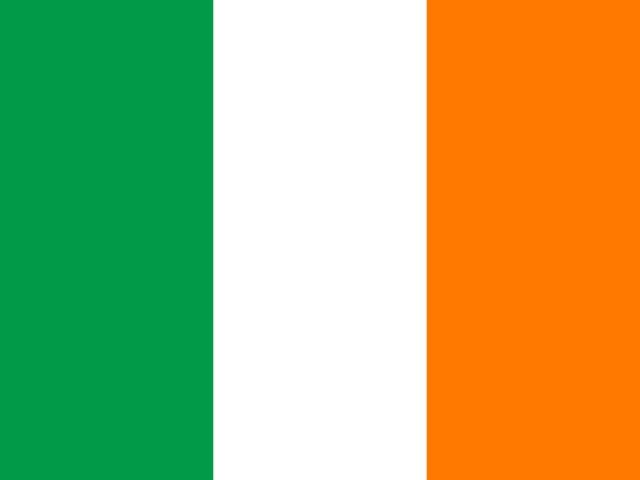
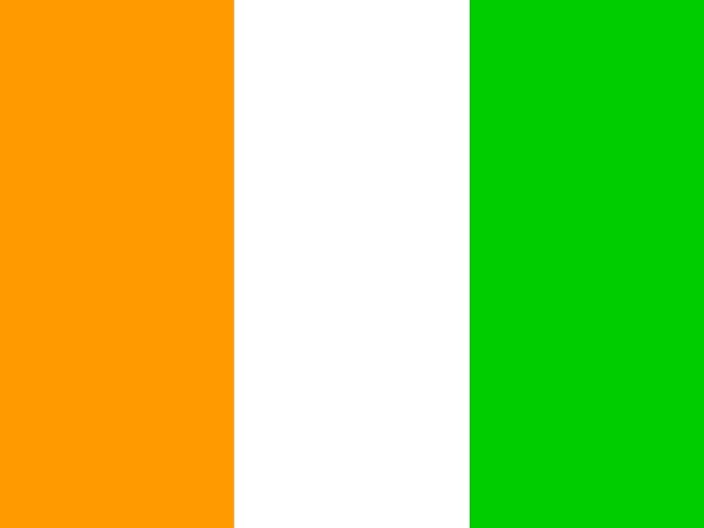
| Ireland | Ivory Coast | |
|---|---|---|
| Capital | Dublin | Yamoussoukro |
| Continent | Europe | Africa |
| Population | 4.9 million | 25.7 million |
| Area | 70,273 km² | 322,463 km² |
| Neighbours | United Kingdom | Burkina Faso, Ghana, Guinea, Liberia and Mali |
| Languages | Irish, English | French |
| Currency | Euro (EUR) | West African CFA franc (XOF) |
Ivory Coast is about 4.6 times the size of Ireland, and Ivory Coast has about 5.2 times the population of Ireland.
Why people mix them up
The two flags are mirror images. Ireland flies green, white and orange from the hoist outwards; Ivory Coast (Côte d'Ivoire) flies orange, white and green. Same three vertical stripes, same colours, opposite order. The only other difference is proportion: the Irish flag is wider (1:2) and the Ivorian flag closer to square (2:3), which is hard to judge on a small screen. Nobody confuses the countries themselves, an island in north-west Europe and a coastal state in West Africa, but in flag rounds they trip up even experienced players.
How to tell them apart
- Ireland's flag starts with green at the hoist; Ivory Coast's starts with orange. Green first means Ireland.
- Ireland is an island in the North Atlantic, west of Great Britain; Ivory Coast is on the Gulf of Guinea coast of West Africa.
- Ivory Coast is more than four times bigger, about 322,000 km² against roughly 70,000 km², with about 29 million people against 5 million.
- Ireland's languages are Irish and English and it uses the euro; Ivory Coast's official language is French and it uses the West African CFA franc.
- Ireland's capital is Dublin; Ivory Coast's official capital is Yamoussoukro, though Abidjan is the largest city and economic centre.
- Ireland's only land border is with the United Kingdom; Ivory Coast borders Liberia, Guinea, Mali, Burkina Faso and Ghana.
Memory hook
Ireland is the "Emerald Isle", so its flag starts with emerald green. Ivory Coast starts with orange, the colour of a West African sunset over the Atlantic.
On the map
For Ireland, find Great Britain off the north-west coast of Europe and tap the island immediately to its west; the quiz wants the large southern part, as Northern Ireland belongs to the UK. For Ivory Coast, find the bottom edge of the West African bulge and tap the country between Liberia on the west and Ghana on the east, with Mali and Burkina Faso on its northern side.
Practise
More like this
- 15 pairs of countries people constantly mix upSlovakia vs Slovenia, Niger vs Nigeria – and how to keep each pair apart.
- Flags that look alike (and how to tell them apart)Chad or Romania? Australia or New Zealand? The flag pairs that cost quiz points.
- The 25 hardest countries to find on a mapPacific islands, Caribbean islands and landlocked Africa – where they are.