Slovakia vs Slovenia
Two countries people mix up, side by side. Facts first, then how to keep them apart on the map.
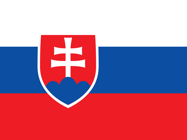
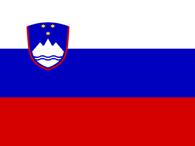
| Slovakia | Slovenia | |
|---|---|---|
| Capital | Bratislava | Ljubljana |
| Continent | Europe | Europe |
| Population | 5.5 million | 2.1 million |
| Area | 49,037 km² | 20,273 km² |
| Neighbours | Austria, Czechia, Hungary, Poland and Ukraine | Austria, Croatia, Hungary and Italy |
| Languages | Slovak | Slovene |
| Currency | Euro (EUR) | Euro (EUR) |
Slovakia is about 2.4 times the size of Slovenia, and Slovakia has about 2.6 times the population of Slovenia.
Why people mix them up
The names are the main culprit: both start with "Slov-", both are small Central European countries that only appeared on the map in the early 1990s, and both fly a white-blue-red horizontal tricolour with a coat of arms near the hoist. Slovakia left Czechoslovakia in 1993, Slovenia left Yugoslavia in 1991, so even their back stories sound alike. Add that they are only a few hundred kilometres apart, both use the euro and both have Austria and Hungary as neighbours, and the confusion is understandable.
How to tell them apart
- Slovakia is landlocked; Slovenia has a short stretch of Adriatic coast around Koper and Piran.
- Slovakia sits north of Hungary; Slovenia sits west of Hungary, wedged between Italy, Austria and Croatia.
- Slovakia is more than twice the size: about 49,000 km² and 5.4 million people, against Slovenia's roughly 20,000 km² and 2.1 million.
- Slovakia's coat of arms is a white double cross on three blue hills; Slovenia's shows the three-peaked Mount Triglav with three gold stars and wavy lines for the sea.
- The capitals are Bratislava (Slovakia) and Ljubljana (Slovenia). Bratislava lies on the Danube, almost touching the Austrian border.
- Slovakia borders Czechia and Poland; Slovenia borders Italy and Croatia, two countries Slovakia never touches.
Memory hook
Slov-A-kia is Above Hungary; Slov-E-nia is at the Edge of the sea. The longer name belongs to the bigger country.
On the map
For Slovakia, start from Hungary and tap the long, thin country directly north of it, between Czechia and Ukraine. For Slovenia, find the top of the Adriatic Sea where Italy's boot meets Croatia; the small country tucked into that corner, just south of Austria, is Slovenia. If what you are tapping has no coastline at all, it is Slovakia.
Practise
More like this
- 15 pairs of countries people constantly mix upSlovakia vs Slovenia, Niger vs Nigeria – and how to keep each pair apart.
- Flags that look alike (and how to tell them apart)Chad or Romania? Australia or New Zealand? The flag pairs that cost quiz points.
- The 25 hardest countries to find on a mapPacific islands, Caribbean islands and landlocked Africa – where they are.