Sudan vs South Sudan
Two countries people mix up, side by side. Facts first, then how to keep them apart on the map.
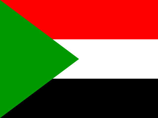
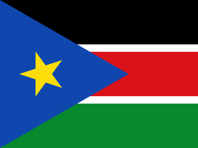
| Sudan | South Sudan | |
|---|---|---|
| Capital | Khartoum | Juba |
| Continent | Africa | Africa |
| Population | 42.8 million | 11.1 million |
| Area | 1,886,068 km² | 619,745 km² |
| Neighbours | Central African Republic, Chad, Egypt, Eritrea, Ethiopia, Libya and South Sudan | Central African Republic, DR Congo, Ethiopia, Kenya, Sudan and Uganda |
| Languages | Arabic, English | English |
| Currency | Sudanese pound (SDG) | South Sudanese pound (SSP) |
Sudan is about 3 times the size of South Sudan, and Sudan has about 3.9 times the population of South Sudan.
Why people mix them up
South Sudan was part of Sudan until it became independent in 2011, which makes it one of the newest countries in the world. Many older maps and atlases still show a single, much larger Sudan, so people are often unsure which country is which or where the border runs. The shared name and the White Nile flowing from one into the other add to the confusion.
How to tell them apart
- Sudan has a Red Sea coastline; South Sudan is landlocked.
- The capitals are Khartoum (Sudan) and Juba (South Sudan).
- Sudan's flag is red, white and black horizontal stripes with a green triangle at the hoist; South Sudan's is black, red and green stripes separated by white lines, with a blue triangle holding a gold star.
- Sudan is the larger country, roughly three times the area of South Sudan.
- Arabic is widely spoken in Sudan, where it is official alongside English; South Sudan's official language is English.
- Sudan lies largely in the Sahara and Sahel; South Sudan is greener, with large wetlands such as the Sudd along the White Nile.
Memory hook
South Sudan is South, landlocked and young, with a star on its flag for a new country. Sudan is the older, bigger northern half that keeps the sea.
On the map
Find Egypt and drop straight south. The large country below Egypt, with a coast on the Red Sea, is Sudan. Keep going south and you reach South Sudan, a landlocked country bordered by Ethiopia, Kenya, Uganda, DR Congo and the Central African Republic. If the country you are tapping touches Kenya or Uganda, it is South Sudan.
Practise
More like this
- 15 pairs of countries people constantly mix upSlovakia vs Slovenia, Niger vs Nigeria – and how to keep each pair apart.
- Flags that look alike (and how to tell them apart)Chad or Romania? Australia or New Zealand? The flag pairs that cost quiz points.
- The 25 hardest countries to find on a mapPacific islands, Caribbean islands and landlocked Africa – where they are.