Croatia vs Serbia
Two countries people mix up, side by side. Facts first, then how to keep them apart on the map.
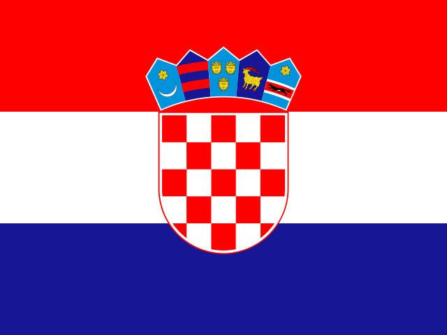
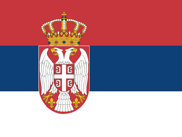
| Croatia | Serbia | |
|---|---|---|
| Capital | Zagreb | Belgrade |
| Continent | Europe | Europe |
| Population | 4.1 million | 6.9 million |
| Area | 56,594 km² | 77,474 km² |
| Neighbours | Bosnia and Herzegovina, Hungary, Montenegro, Serbia and Slovenia | Bosnia and Herzegovina, Bulgaria, Croatia, Hungary, Kosovo, Montenegro, North Macedonia and Romania |
| Languages | Croatian | Serbian |
| Currency | Euro (EUR) | Serbian dinar (RSD) |
Serbia is about 1.4 times the size of Croatia, and Serbia has about 1.7 times the population of Croatia.
Why people mix them up
Croatia and Serbia are neighbours that were both part of Yugoslavia until the early 1990s. Their standard languages are very close and mutually understandable, and both flags are red, white and blue horizontal tricolours with a coat of arms. For people outside the region the names also sound alike, as two-syllable Balkan countries ending in "-ia", so they are often swapped in quizzes and in conversation.
How to tell them apart
- Croatia has a long Adriatic coastline with more than a thousand islands; Serbia is landlocked.
- Croatia's flag runs red-white-blue from top to bottom with a red-and-white checkerboard shield; Serbia's runs red-blue-white with a white double-headed eagle.
- Croatian is written in the Latin alphabet; Serbian uses both Cyrillic and Latin, with Cyrillic as the official script.
- Croatia is in the European Union and uses the euro; Serbia is not an EU member and uses the dinar.
- The capitals are Zagreb (Croatia) and Belgrade (Serbia). Belgrade stands where the Sava meets the Danube.
- Croatia has a curved, crescent-like shape; Serbia is a more compact block further inland to the east.
Memory hook
Croatia has the Coast and the Checkerboard; Serbia is the one Surrounded by land.
On the map
Find the eastern shore of the Adriatic Sea. Croatia is the country hugging that shore in a long thin strip, then bending northeast inland towards Hungary, forming a curve around Bosnia and Herzegovina. Serbia lies further east, inland, bordering Hungary, Romania and Bulgaria, with the Danube flowing through its north. If the country you are tapping touches the sea, it is Croatia.
Practise
More like this
- 15 pairs of countries people constantly mix upSlovakia vs Slovenia, Niger vs Nigeria – and how to keep each pair apart.
- Flags that look alike (and how to tell them apart)Chad or Romania? Australia or New Zealand? The flag pairs that cost quiz points.
- The 25 hardest countries to find on a mapPacific islands, Caribbean islands and landlocked Africa – where they are.