Kenya vs Tanzania
Two countries people mix up, side by side. Facts first, then how to keep them apart on the map.
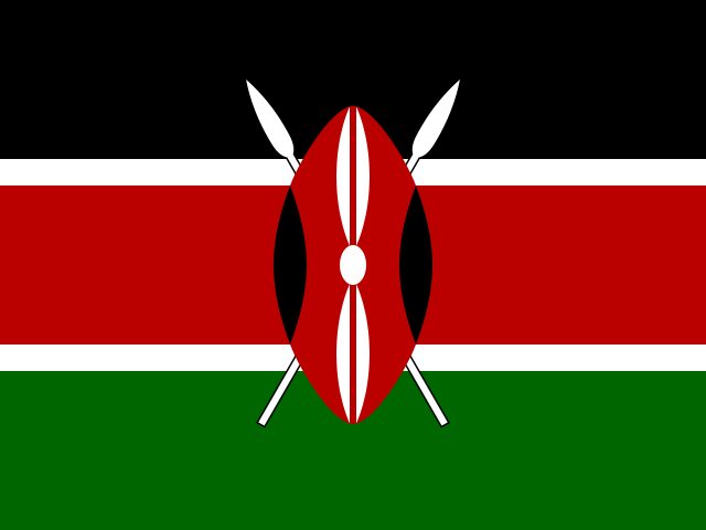
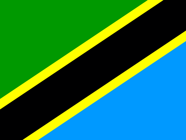
| Kenya | Tanzania | |
|---|---|---|
| Capital | Nairobi | Dodoma |
| Continent | Africa | Africa |
| Population | 52.6 million | 58 million |
| Area | 580,367 km² | 945,087 km² |
| Neighbours | Ethiopia, Somalia, South Sudan, Tanzania and Uganda | Burundi, DR Congo, Kenya, Malawi, Mozambique, Rwanda, Uganda and Zambia |
| Languages | English, Swahili | Swahili, English |
| Currency | Kenyan shilling (KES) | Tanzanian shilling (TZS) |
Tanzania is about 1.6 times the size of Kenya, and Tanzania has about 1.1 times the population of Kenya.
Why people mix them up
Kenya and Tanzania are East African neighbours on the Indian Ocean. Swahili is spoken in both, they share Lake Victoria (with Uganda) and the same great savanna ecosystem: Kenya's Maasai Mara and Tanzania's Serengeti are two halves of the area crossed by the great wildebeest migration. Mount Kilimanjaro can be seen from Kenya, so many people assume it is Kenyan, when it actually stands in Tanzania.
How to tell them apart
- Kilimanjaro, Africa's highest mountain, is in Tanzania, just south of the Kenyan border; Mount Kenya, the second highest, is in Kenya.
- Kenya's flag has black, red and green horizontal stripes with a Maasai shield and spears; Tanzania's has a black diagonal band edged in yellow, with green and blue triangles.
- Kenya's capital is Nairobi; Tanzania's official capital is Dodoma, while Dar es Salaam is its largest city.
- Tanzania is the larger country, about 945,000 km² against Kenya's roughly 580,000 km².
- The Equator crosses Kenya; Tanzania lies entirely in the Southern Hemisphere.
- The islands of Zanzibar belong to Tanzania.
Memory hook
Kenya sits on the Equator, Tanzania sits on the Kilimanjaro side. Tanzania's name comes from Tanganyika plus Zanzibar, so the one with the islands is Tanzania.
On the map
Find the East African coast below Somalia. Kenya is the country directly south of Ethiopia and Somalia, with the Equator running through it and Lake Turkana in its north. Tanzania is the larger country below Kenya, stretching from Lake Victoria to Lake Tanganyika and down to Mozambique. If the country you are tapping touches Mozambique or Zambia, it is Tanzania.
Practise
More like this
- 15 pairs of countries people constantly mix upSlovakia vs Slovenia, Niger vs Nigeria – and how to keep each pair apart.
- Flags that look alike (and how to tell them apart)Chad or Romania? Australia or New Zealand? The flag pairs that cost quiz points.
- The 25 hardest countries to find on a mapPacific islands, Caribbean islands and landlocked Africa – where they are.