Serbia vs Montenegro
Two countries people mix up, side by side. Facts first, then how to keep them apart on the map.
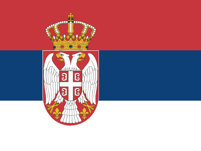
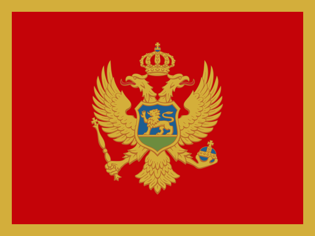
| Serbia | Montenegro | |
|---|---|---|
| Capital | Belgrade | Podgorica |
| Continent | Europe | Europe |
| Population | 6.9 million | 622,137 |
| Area | 77,474 km² | 13,812 km² |
| Neighbours | Bosnia and Herzegovina, Bulgaria, Croatia, Hungary, Kosovo, Montenegro, North Macedonia and Romania | Albania, Bosnia and Herzegovina, Croatia, Kosovo and Serbia |
| Languages | Serbian | Serbian, Bosnian, Albanian, Croatian |
| Currency | Serbian dinar (RSD) | Euro (EUR) |
Serbia is about 5.6 times the size of Montenegro, and Serbia has about 11.2 times the population of Montenegro.
Why people mix them up
Serbia and Montenegro were joined in a single state, also called Serbia and Montenegro, until Montenegro became independent in 2006. Many older maps, atlases and sports records still show them together, so people are often unsure where one ends and the other begins. They are neighbours, their standard languages are very close, and both national coats of arms feature a double-headed eagle.
How to tell them apart
- Montenegro has a coastline on the Adriatic Sea; Serbia is landlocked.
- Serbia is far larger, more than five times the area of Montenegro's roughly 14,000 km², and it has many more people.
- Serbia's flag is a red-blue-white horizontal tricolour; Montenegro's is a red field with a gold border and a gold double-headed eagle in the centre.
- Montenegro uses the euro, even though it is not an EU member; Serbia uses the dinar.
- The capitals are Belgrade (Serbia) and Podgorica (Montenegro).
- Montenegro is mountainous almost everywhere; Serbia's north is the flat Pannonian Plain along the Danube.
Memory hook
Montenegro means "black mountain", and it is the mountain that runs down to the sea. Serbia is the big inland country behind it.
On the map
Follow the Adriatic coast southeast from Croatia. Just before you reach Albania, there is a small country with a short, rugged coastline and the Bay of Kotor: that is Montenegro. Serbia lies inland to the northeast, bordering Hungary, Romania and Bulgaria. If the country you are tapping has no sea and touches the Danube, it is Serbia.
Practise
More like this
- 15 pairs of countries people constantly mix upSlovakia vs Slovenia, Niger vs Nigeria – and how to keep each pair apart.
- Flags that look alike (and how to tell them apart)Chad or Romania? Australia or New Zealand? The flag pairs that cost quiz points.
- The 25 hardest countries to find on a mapPacific islands, Caribbean islands and landlocked Africa – where they are.