Congo vs DR Congo
Two countries people mix up, side by side. Facts first, then how to keep them apart on the map.
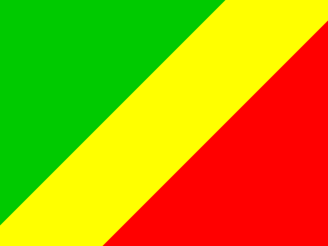
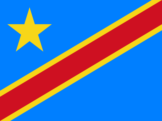
| Congo | DR Congo | |
|---|---|---|
| Capital | Brazzaville | Kinshasa |
| Continent | Africa | Africa |
| Population | 5.4 million | 86.8 million |
| Area | 342,000 km² | 2,344,858 km² |
| Neighbours | Angola, Cameroon, Central African Republic, DR Congo and Gabon | Angola, Burundi, Central African Republic, Congo, Rwanda, South Sudan, Tanzania, Uganda and Zambia |
| Languages | French, Lingala | French, Lingala, Kongo, Swahili, Luba-Katanga |
| Currency | Central African CFA franc (XAF) | Congolese franc (CDF) |
DR Congo is about 6.9 times the size of Congo, and DR Congo has about 16.1 times the population of Congo.
Why people mix them up
Two neighbouring countries in Central Africa share the same name, the same river and the same official language. The Republic of the Congo (often "Congo-Brazzaville") and the Democratic Republic of the Congo ("DR Congo" or "Congo-Kinshasa") are separated only by the Congo River, and their capitals sit directly opposite each other on its banks, the closest pair of capital cities in the world. DR Congo was called Zaire from 1971 to 1997, which adds to the muddle.
How to tell them apart
- DR Congo is enormous, about 2.34 million km² and the second-largest country in Africa; the Republic of the Congo is roughly 342,000 km².
- The Republic of the Congo is north and west of the river; DR Congo is on the south and east bank and spreads far to the east, reaching the African Great Lakes.
- DR Congo has well over 100 million people; the Republic of the Congo has about 6 million.
- The Republic of the Congo's flag is green, yellow and red split diagonally; DR Congo's is sky blue with a yellow star and a red diagonal stripe edged in yellow.
- The capitals are Brazzaville (Republic of the Congo) and Kinshasa (DR Congo), facing each other across the Congo River.
- DR Congo borders nine countries, including Uganda, Rwanda, Tanzania and Zambia; the Republic of the Congo borders Gabon, Cameroon, Central African Republic and DR Congo.
Memory hook
The long name belongs to the big country: "Democratic Republic" is the giant, plain "Congo" is the small one on the Atlantic side of the river.
On the map
For DR Congo, tap the huge country in the very middle of Africa, filling the space between Angola in the south and the Central African Republic in the north, with the Great Lakes on its eastern edge. For the Republic of the Congo, look at DR Congo's north-western corner, where the border runs along the river, and tap the smaller country on the other side, between Gabon and DR Congo, with a short Atlantic coastline.
Practise
More like this
- 15 pairs of countries people constantly mix upSlovakia vs Slovenia, Niger vs Nigeria – and how to keep each pair apart.
- Flags that look alike (and how to tell them apart)Chad or Romania? Australia or New Zealand? The flag pairs that cost quiz points.
- The 25 hardest countries to find on a mapPacific islands, Caribbean islands and landlocked Africa – where they are.